
Figures & data
Fig. 1 Geographical position of the study area ‘‘El Bayadh”.
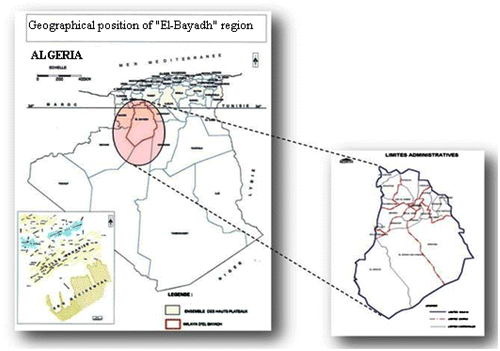
Table 1. Land area for soils of different classes of vulnerability (Forest Service of the wilaya of El Bayadh, 2012)
Table 2. Mean Monthly rainfall of El Bayadh Metrology Station (1971–2010)
Fig. 2 Year classification according to rainfall.
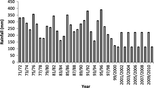
Table 3. Distribution of average monthly temperatures (Period: 1971–2010)
Fig. 3 Ombro-thermal diagram for the study area ‘‘El Bayadh” (1971–2010).
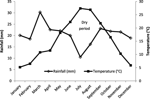
Table 4. Wind speeds in the wilaya of El Bayadh (Period: 2006/2007)
Table 5. Nature of water in the wilaya (This data is obtained from the National Agency for Hydraulic Resources of the wilaya of El Bayadh, NAHR, 2012)