Figures & data
Figure 1. Boundary of Comprehensive Development Plan compared with the built up area from 2012 satellite image.
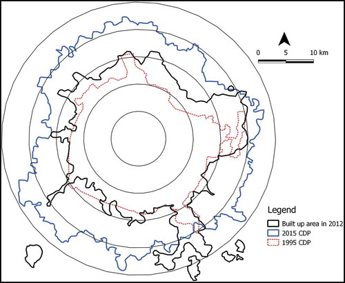
Figure 2. Terrain of Bengaluru with valley system.
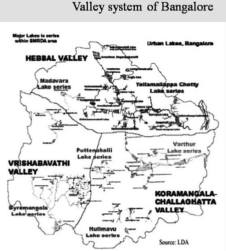
Figure 3. Water sources shifting away from the city.
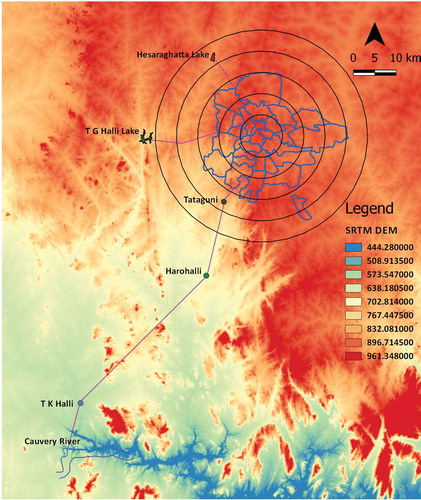
Table 1. Details of water supply to each subdivision.
Figure 4. Subdivisions of BWSSB jurisdiction overlaid on SRTM DEM.
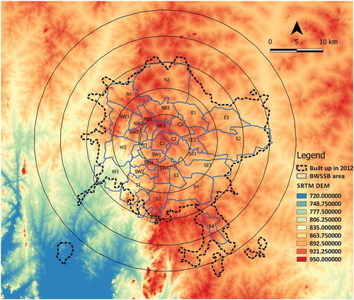
Figure 5. The details of pumping to different subdivisions of BWSSB.
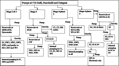
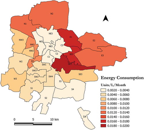
Figure 6. The spatial pattern of energy consumption in BWSSB subdivisions.