Figures & data
Figure 1. The remotely sensed land cover distribution for Hartford County.
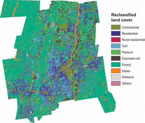
Figure 2. Spatial distribution of population density at the block group level.
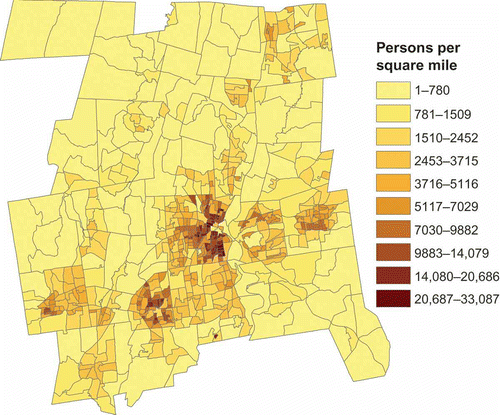
Figure 3. Spatial distribution of the GWR coefficient at the block group level in the 50 GWR2 BLKG model: (a) for residential land cover; (b) for rural residential land cover.
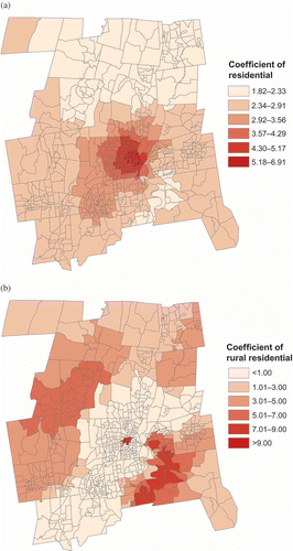
Table 1. Results of the block group interpolation
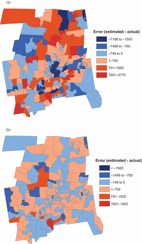
Figure 4. Spatial distribution of error by block group for the 50 GWR2 BLKG model (a) before scaling, (b) after scaling.
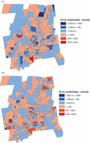
Figure 5. Spatial distribution of error by block group for the OLS1 model (a) before scaling, (b) after scaling.
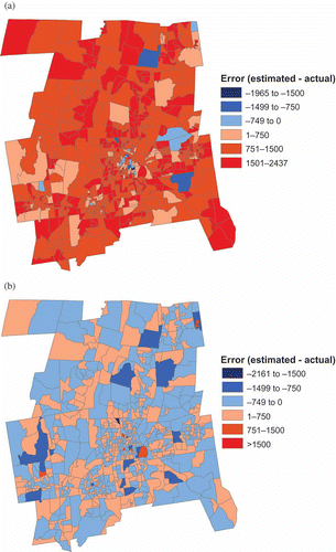
Table 2. Results of pseudo-tract interpolation
Figure 6. Spatial distribution of error by pseudo-tract for the 50 GWR3 PTRC model (a) before scaling, (b) after scaling.
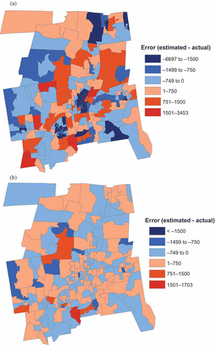
Figure 7. Spatial distribution of error by pseudo-tract for the 160 GWR2 PTRC model (a) before scaling, (b) after scaling.