Figures & data
Figure 1. Annual sediment load computed from hydrograph survey.
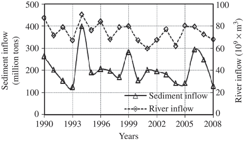
Table 1. Sediment data of the selected world rivers (WAPDA Citation1991)
Figure 3. Simulated ALOS/AVNIR-2 reflectance of varying SSC (0–1000 mg/l).
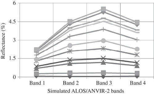
Figure 4. Relationship between SSC and the developed reflectance model.
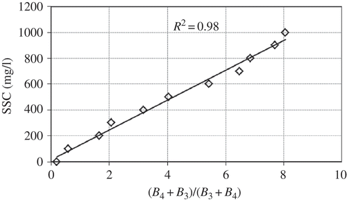
Figure 2. Spectral reflectance of water with varying concentrations of collected soil samples.
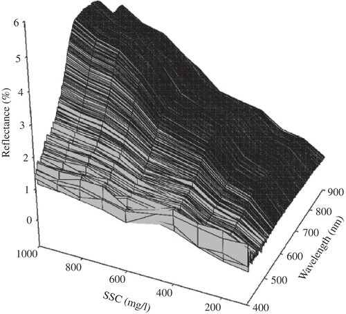
Figure 5. ALOS/AVNIR-2 image of Tarbela Dam and Indus River, Pakistan. Acquisition date: 6 October 2006.
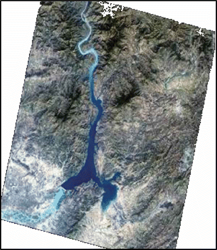
Figure 6. Spectral comparison between modeled and ALOS/AVNIR reflectance data.
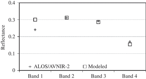
Figure 7. Reflectance pattern of ALOS/AVNIR-2 satellite data at every 10 km along the Indus River upstream of the dam.
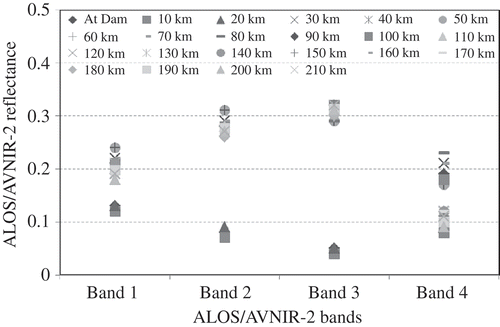
Figure 8. SSC distribution along the Indus River upstream of the dam derived from ALOS/AVNIR-2 satellite image by model inversion technique.
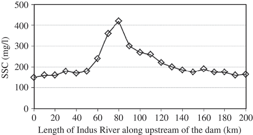
Figure 9. SSC along the river reach upstream of the dam derived from SPOT satellite image by model inversion technique.
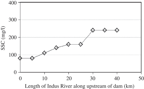
Figure 11. Relationship between SSC (mg/l) and the developed two-band ALOS/AVNIR-2 reflectance model.
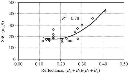
Figure 10. ALOS/AVNIR-2 reflectance [(B 4+B 3)/(B 3/B 4)] pattern along the Indus River upstream of the dam.
![Figure 10. ALOS/AVNIR-2 reflectance [(B 4+B 3)/(B 3/B 4)] pattern along the Indus River upstream of the dam.](/cms/asset/6049f9df-96c0-4ee9-a9b3-3bd91ea1e560/tagi_a_576267_o_f0010g.gif)
Figure 13. Relationship between SSC and the developed SPOT (two-band) reflectance model.
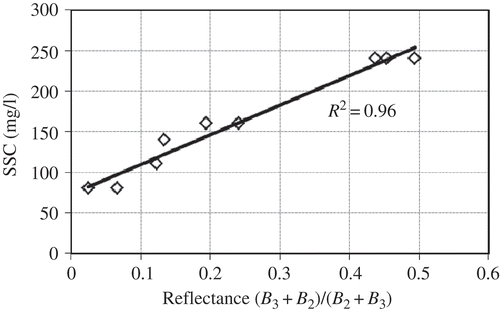
Figure 12. SPOT-2 reflectance [(B 3+B 2)/(B 2/B 3)] pattern along the Indus River upstream of the dam.
![Figure 12. SPOT-2 reflectance [(B 3+B 2)/(B 2/B 3)] pattern along the Indus River upstream of the dam.](/cms/asset/99215d00-2808-4c30-b09e-cb1b003c252d/tagi_a_576267_o_f0012g.gif)