
Figures & data
Figure 1. Framework of proposed methodology.
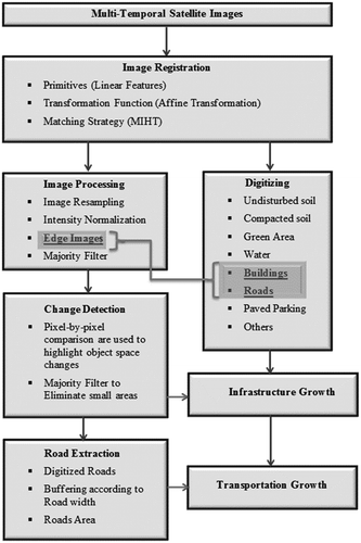
Figure 2. The study area: (a) location map and (b) Sharjah City.
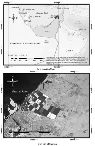
Table 1. Landsat images captured over 40 years period.
Figure 3. Multi-temporal Landsat images for Sharjah City.
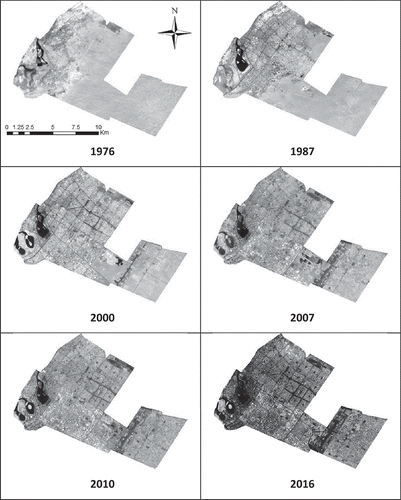
Figure 4. Google Earth geo-referenced images for Sharjah City.
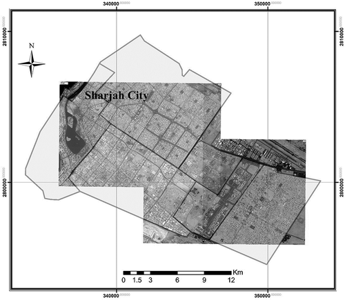
Figure 5. Landsat images for years 1987 and 2010: (a) registered images and (b) edge images.
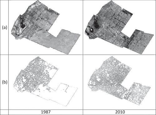
Table 2. Area of roads and buildings over the 40-year period in Sharjah City.
Figure 6. (a) Multi-temporal Landsat image for Sharjah City years 2010 and 1987 and (b) change-detection image where black pixels represent change.
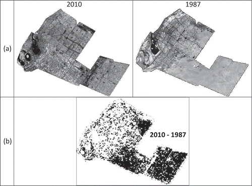
Figure 7. Urban growth from 1976 to 2016 based on image processing.
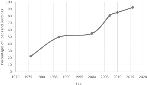
Figure 8. Detected road features in resulting edge images.
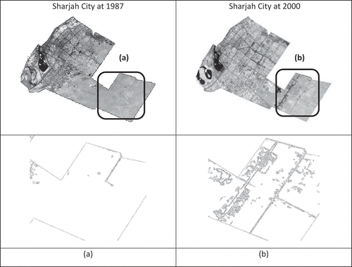
Figure 9. Detected building features in resulting edge images.
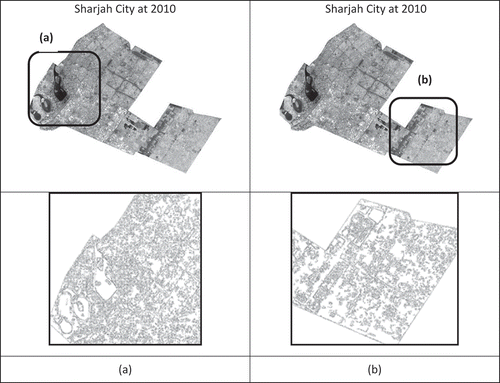
Figure 10. Urban growth of downtown Sharjah City in resulting edge images.
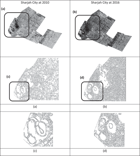
Figure 11. Digitized land cover/land use features for Sharjah City for 2004 and 2013.
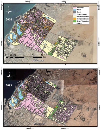
Table 3. Areas of the digitized land cover/land use features for 1976, 2004 and 2013.
Figure 12. Distribution of digitized land cover/land use features for 1976, 2004 and 2013.
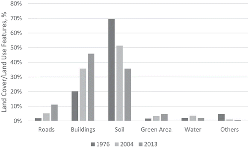
Figure 13. Growth trends of roads and buildings for 1976, 2004 and 2013.
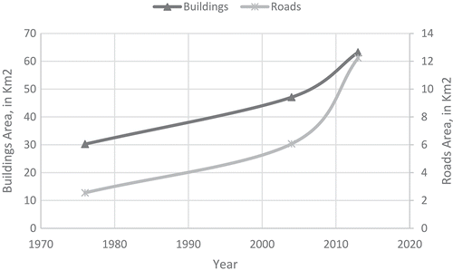
Figure 14. Urbanization (roads and buildings) and population trends based on digitized features.
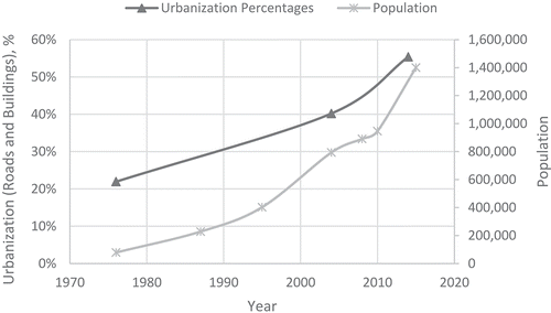
Table 4. Urban areas and AUSEI results based on edge images from 1976 to 2016.
Figure 15. Urbanization (roads and buildings) and population trends based on edge images.
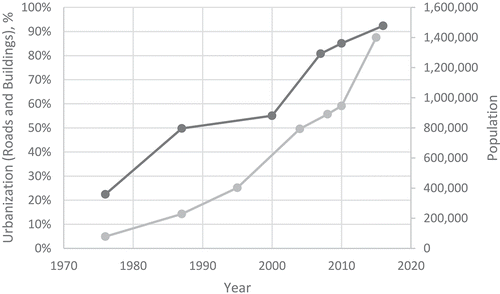
Table 5. Urban areas and AUSEI results based on digitized features for 1976, 2004 and 2013.
Figure 16. Comparison of urbanization and population trends based on edge images and digitized features.
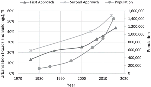
Table 6. Accuracy assessment of 1987 and 2010 edge images and the 1987–2010 difference/change image.