
Figures & data
Figure 1. An example of the ‘constructed’ questionnaire.
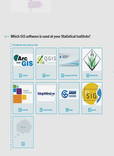
Table 1. Main questions and their number on the questionnaire.
Figure 2. Reply to the online survey.
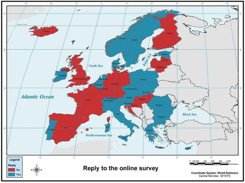
Figure 3. An example of the produced results by Typeform.
Figure 4. GIS in the SIs of EU and EFTA countries.
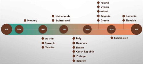
Table 2. Data layers that each SI manages.
Table 3. Maps which are produced by each SI using GIS.
Table 4. Tasks that are conducted through BI.
Table 5. Census frequency and use of geospatial technology during census.