
Figures & data
Figure 1. Location of the study case
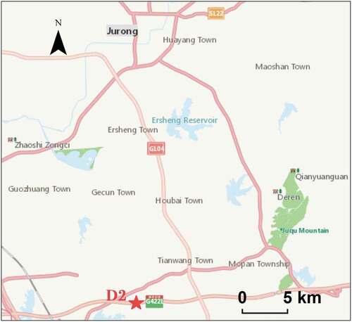
Figure 2. Necropolis D2
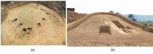
Figure 3. 3D coordinates calculation based on laser scanner

Figure 4. Original LiDAR points (a, b, c) and registration (d)
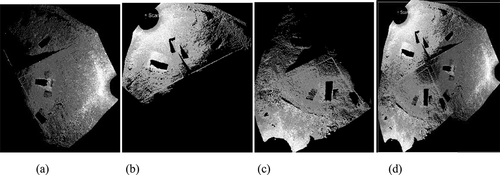
Figure 5. Flowchart of the data pre-processing
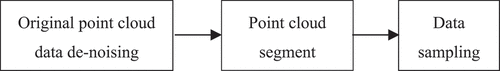
Figure 6. Graves numbers
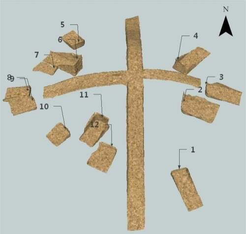
Figure 7. Inscribed circle of centripetalism
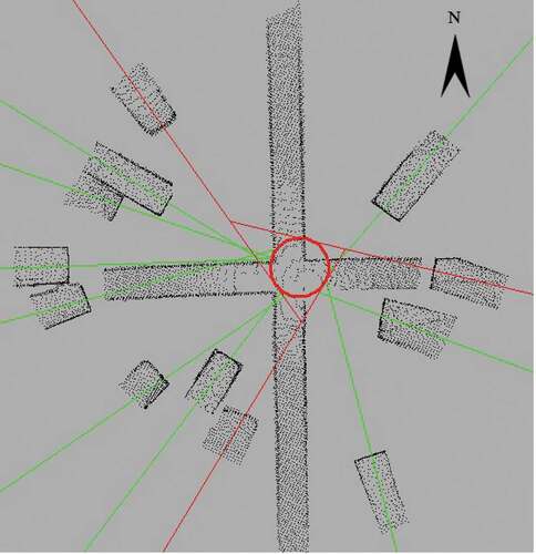
Figure 8. Flowchart of determining the common area of all orientation lines
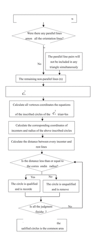
Figure 9. Centres of the inscribed circle and grave M22
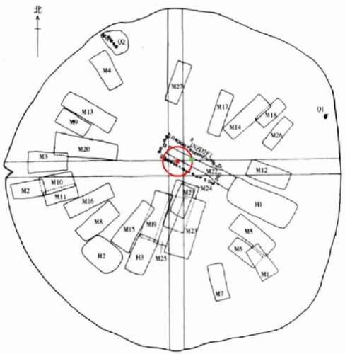
Figure 10. Tombs division based on multiple difference calculation
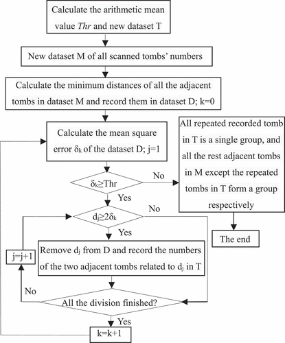
Figure 11. Division of 12 tombs (tombs in one ellipse as one family group)
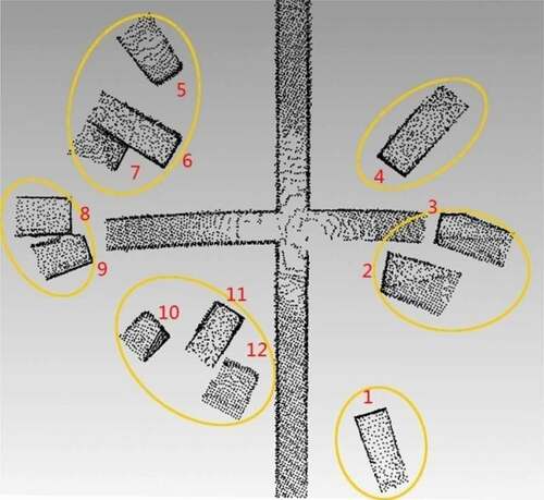
Table 1. Division process of the 12 tombs (m)