
Figures & data
Figure 1. Location of study area.
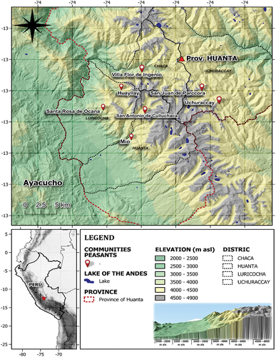
Figure 2. The different land covers identified in the present study. (a) lake; (b) high Andean grassland; (c) forest plantation; (d) wetlands; (e) rocky outcrop; (f) scrubland; (g) bare soil; (h) high Andean scrubland; (i) Croplands; and (j) scrubland of Dodonaea viscosa jacq.
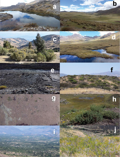
Table 1. List of land cover.
Table 2. List of the multispectral images used in the present study.
Figure 3. Multitemporal-LandSat verification of land cover types in district the Huanta and Luricocha, province the Huanta, Ayacucho Department, Central Andes of Peru.
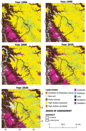
Figure 4. Transition of the land covers in the multitemporal-Landsat images. (ro) rocky outcrop; (we) wetlands; (La) Lake; (HaSL) high Andean scrubland; (FP) forest plantations; (SLD) scrublands of Dodonea viscosa; (Bsl) bare soil; (cr) croplands; (sc) scrublands; and (gr) high Andean grassland.
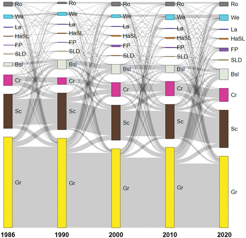
Table 3. Estimated values of the linear regression parameters with their level of significance and coefficient of determination.
Figure 5. (a) Error-adjusted estimated areas of change and associated 95% confidence intervals for land cover. (b) Error-adjusted normalized areas and confidence intervals scaled by land cover. Rocky outcrops (a), croplands (b), Wetland (c), Lake (d), high andean scrublands (e), scrublands (f), high andean grasslands (g), forest plantations (h), scrublands of dodonaea viscosa (i), bare soil (j).
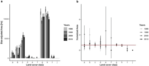
Table 4. Landscape metrics.