Figures & data
Figure 1. False colour composite of Landsat Thematic Mapper satellite of the Nile Delta. Green refers to agricultural lands. Numbers 1 to 4 refer to the coastal lagoons of Manzala (1), Burullus (2), Idku (3) and Maryout (4).
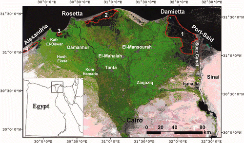
Figure 2. Population distribution of the Nile Delta governorates according to the Egyptian Central Agency for Mobilization and Statistics based on the last 2006 census.
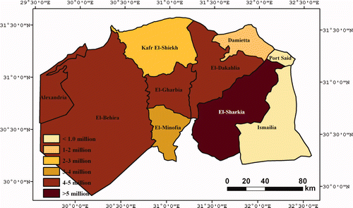
Figure 3. DEM classification for: Nile Delta today (top), 1 m sea level rise (middle) and 2 m sea level rise (bottom). Blue refers to areas to be flooded by the sea. Available in colour online.
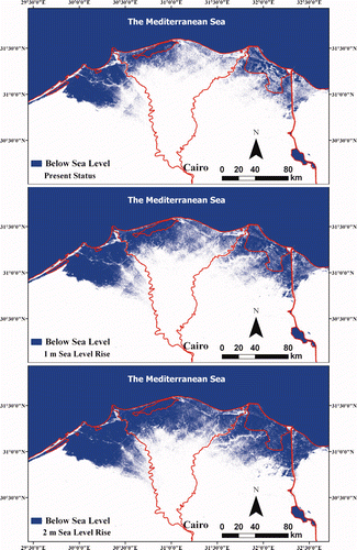
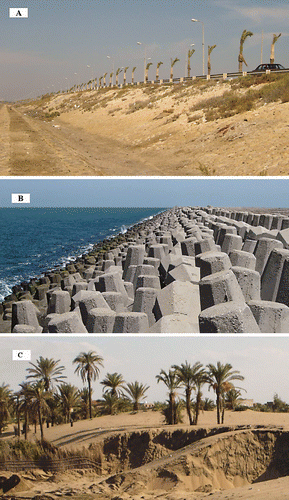
Figure 4. (A) is the northern bank of the international coastal highway which rises by 1–2 m above ground level; (B) is the seawall constructed at Damietta promontory with an elevation of more than 2 m; and (C) shows practices of sand dune removal at the delta coast.