Figures & data
Figure 1 Tropical rainfall measuring mission (TRMM) of NASA showing rainfall on 17 June 2013 (Source: http://trmm.gsfc.nasa.gov). The violet colour indicates rainfall of about 350 mm. White triangle denotes the location of Kedarnath
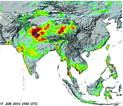
Figure 2 A pre- and post-flood image of the Uttarakhand, and western Nepal and adjoining Tarai region from MODIS on NASA's aqua satellite (Source: http://earthobservatory.nasa.gov/IOTD/view.php?id=81450). Note high discharge in the rivers in the post-image
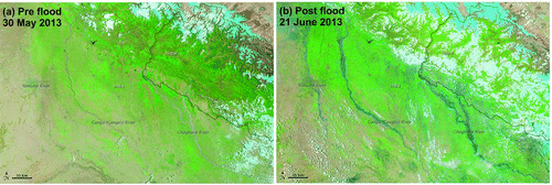
Figure 3 Location of Kedarnath along with the earthquakes of past 50 years (red dots) over Google earth
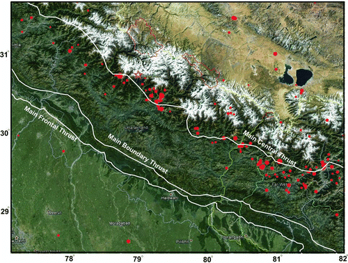
Figure 4 Kedarnath settlement before and after the flood. Note heavy damage and widening of channels in the northern part. (Source: http://bhuvan-noeda.nrsc.gov.in/projects/flood/)
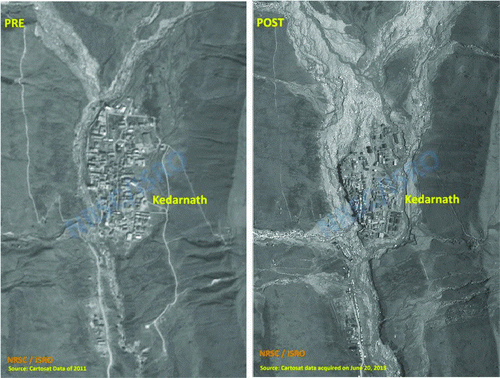
Figure 5 A pre- and post-image of region north of Kedarnath, showing heavy inflow with large amounts of silt. (Source: http://bhuvan-noeda.nrsc.gov.in/projects/flood/)
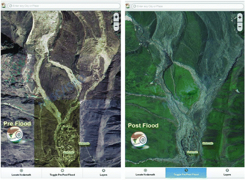
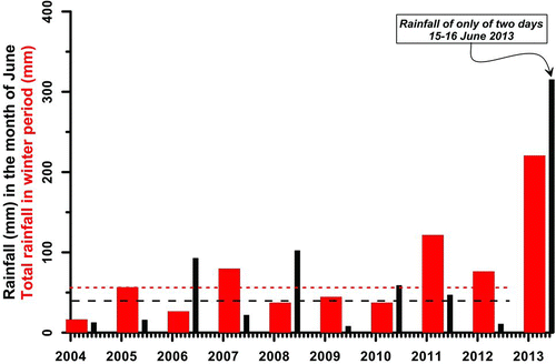
Figure 6 Rainfall record at Srinagar, about 65 km south of Kedarnath using data from India Meteorological Department. Two dashed lines denote the mean of the last nine years of rainfall in June and in winters