
Figures & data
Figure 1. The study area location in Iran and the three region positions (IRS-1D-Pan, July 2002).
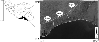
Figure 2. The designed analytical hierarchical structure (AHP).
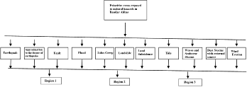
Table 1. Experience of an earthquake in Bandar Abbas city.
Table 2. Calculation of flood flow rate.
Table 3. Decision-making matrix.
Table 4. Relative weight of parameters.
Table 5. Dimensionless matrix.
Table 6. Value of Pij and ln(Pij).
Figure 3. The distribution of 12 natural hazards in every region.
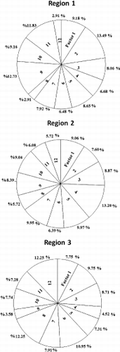
Figure 4. Diameter matrix.
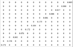
Table 7. The value of Ej, Dj, Wj, Tj and Wj′.
Table 8. Weighted dimensionless matrix.
Table 9. Determining (A−) and (A +).
Table 10. The values of (di−) and (di+).
Table 11. The values of cli+ and its ranking.