Figures & data
Figure 1. Administrative boundary map of Bahraich.
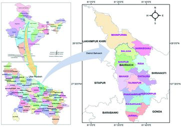
Figure 2. Topography of the district Bahraich.
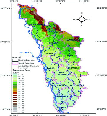
Table 1. Status of hand pump and tested hand pump in district Bahraich.
Table 2. Arsenic test result, ranges and affected gram panchayats.
Figure 3. Arsenic-affected village in Bahraich.
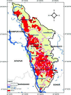
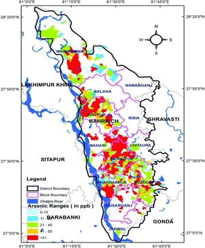
Figure 4. Categorization of arsenic ranges in Bahraich district.