Figures & data
Table 1. Entities of the proposed relational model.
Figure 1. Conceptual model of the proposed relational database, represented as an Entity - Relationship Diagram (ERD); spatial entities are in grey boxes.
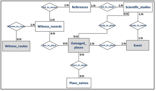
Figure 2. ERD including information of the logical model for the proposed data archive, designed using SQL Power Architect Community Edition. Green: georeferenced entities; orange: reference documents; light blue: junction tables (to implement the case of many-to-many relationships).
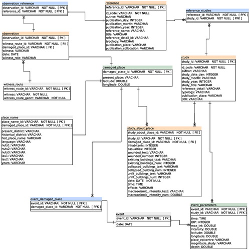
Figure 3. Plot of the epicentre (star) and the macroseismic intensities (dots) related to the 27 April 1894 event according to the study by Makropoulos and Kouskouna (Citation1994). General-Karte des KönigreichsGriechenland © British Library Board.\
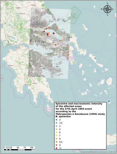
Figure 4. Plot of the epicentre (star) and the macroseismic intensities (dots) related to the 27 April 1894 event according to the study by Albini and Pantosti (Citation2004). General-Karte des KönigreichsGriechenland © British Library Board.
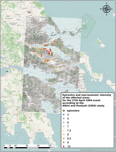
Figure 5. The witness routes geo-referenced on the General-Karte des Königreichs Griechenland, edited in 1885. General-Karte des KönigreichsGriechenland © British Library Board.
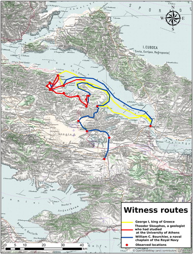
Figure 6. Results of the selection of considered data sources by the two seismological studies performed on a specific earthquake, in the example the 20 April 1894, event in Locris.
Figure 7. Results of the selection of considered data sources by a specific seismological study, that includes both previous seismological studies and historical sources, in this example the Albini and Pantosti (Citation2004) study.
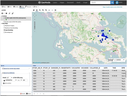
Figure 8. An example of results retrieved by a complex query on the database, as shown in a Web browser using the Open Source web-based GeoNode graphical user interface environment.