
Figures & data
Figure 1. Overview map of Ordos.
(China map vector boundary from the Ministry of Natural Resources: GS(2020)4619, no modification from the base map boundary)

Figure 2. Map of plus model driving factors.
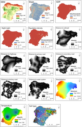
Table 1. The data sources used in this research.
Figure 3. Technology road map.
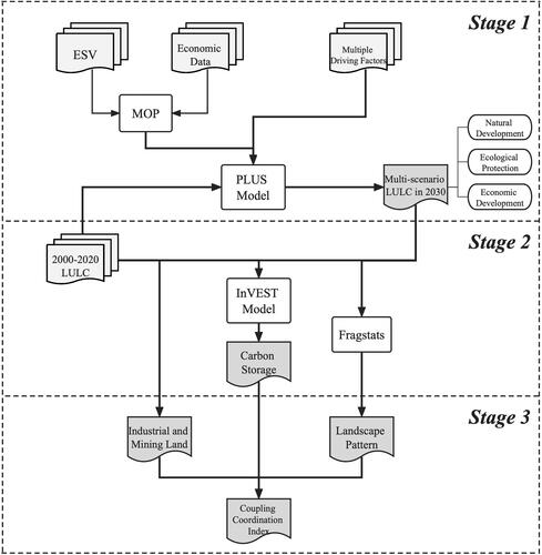
Table 2. Carbon density of land use types in Ordos (t/hm2).
Table 3. Table of ecosystem service values per unit area by category in Ordos (CNY/hm2).
Table 4. Selection of the landscape pattern index and its description.
Table 5. Classification level of coupling coordination degree.
Figure 4. Land use map of Ordos from 2000 to 2020.
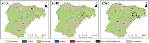
Table 6. Area and proportion of land use types in Ordos by period from 2000 to 2020 (km2).
Table 7. Land use transfer matrix in Ordos from 2000 to 2020 (km2).
Figure 5. Distribution of carbon storage in Ordos from 2000 to 2020.
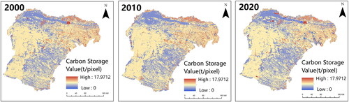
Table 8. Land use carbon storage in Ordos from 2000 to 2020 (106t).
Figure 6. Land use distribution of three predicted scenarios in Ordos.
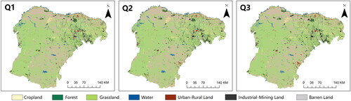
Table 9. Area of different land use types in 2030 under different development scenarios and their changes compared to 2020 in Ordos (km2).
Figure 7. Carbon storage distribution of three predicted scenarios in Ordos.
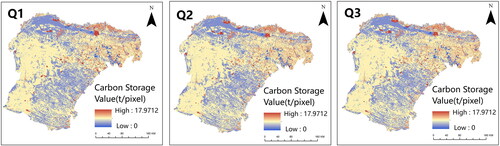
Table 10. Carbon storage of different land use types in 2030 under different development scenarios and their changes compared to 2020 in Ordos (106t).
Table 11. Coupling coordination degree of industrial mining land, landscape pattern and carbon storage.
Data availability statement
The data is available from the authors upon reasonable request.