
Figures & data
Figure 1. Concept map of earthquake disaster city digital twin.
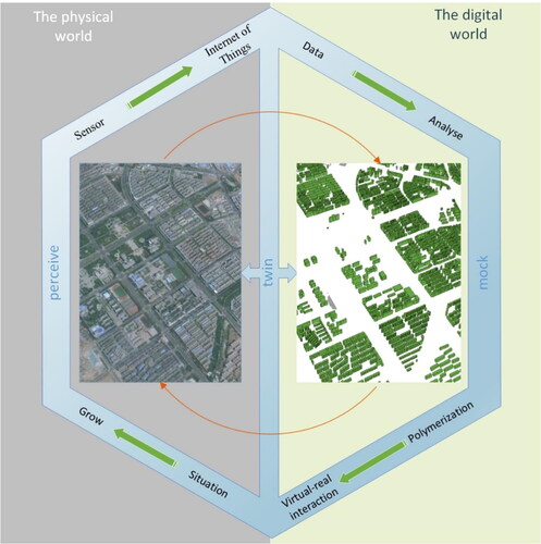
Figure 2. Local point cloud data.
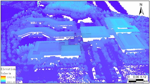
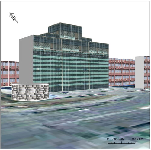
Figure 3. Local 3D base model of the city.
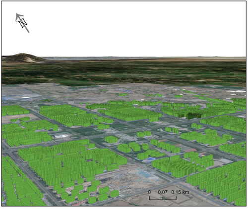
Figure 4. Technical route of digital twin construction in earthquake disaster city.
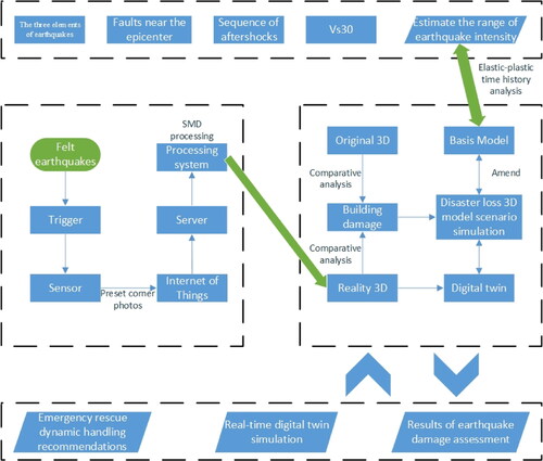
Figure 5. Intensity results of the ground motion attenuation model.
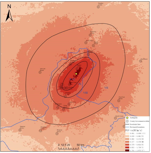
Table 1. Comparison of model calculated intensity and historical calculated intensity.
Figure 6. Overview of the study area.
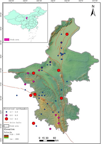
Figure 7. Simulated seismic intensity.
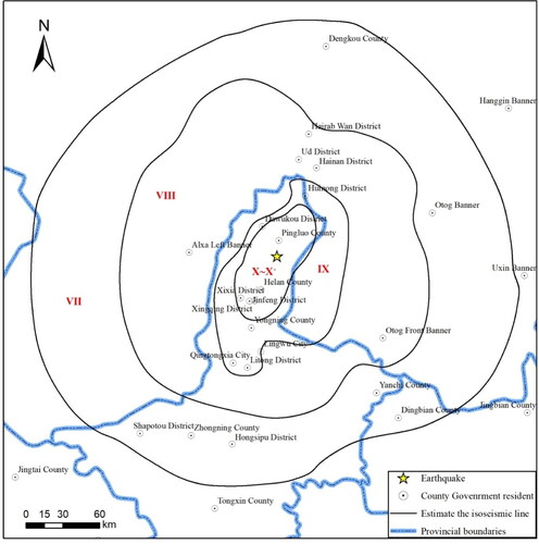
Figure 8. Earthquake damage distribution of buildings in Pingluo County.
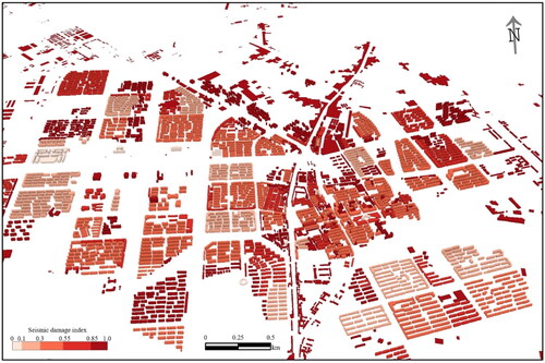
Table 2. Earthquake damage of buildings.
Figure 9. Fusion of preset angle photo and 3D model patch.
Data availability statement
Seismic and earthquake-shaking data were obtained by contacting the corresponding author on reasonable grounds.