Figures & data
Figure 1. (a) Location map of the study area, (b) a geological cross-section (a,b, Fig. 1) crossing the study area (modified after RIGW, Citation1993), (b) geological map (modified after CONCO Citation1987), (c) structural geological map of the study area, (d) a geological cross-section (a,b, Fig. 1a) crossing the area (modified after RIGW, Citation1993) and (e) borehole data of RWEDEA well showing the subsurface geological sequence and different aquifers in the area.
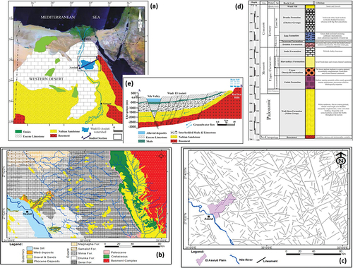
Figure 2. (a) RTP aeromagnetic map with locations of chosen profiles utilised for 2D aeromagnetic and gravity forwarded modelling, (b) first vertical derivative map and (c) tilt derivative map.
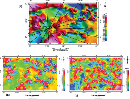
Figure 3. Euler deconvolution maps when (a) SI = 0, (b) SI = 0.5 and (c) SI = 1.
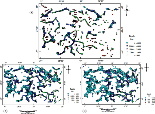
Figure 4. (a) Bouguer gravity map, (b) low-pass gravity filter map and (c) high-pass gravity filter map.
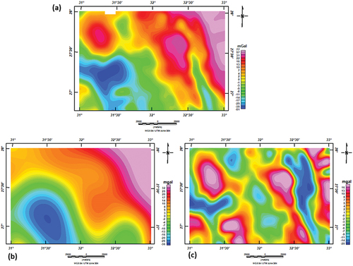
Figure 5. Apparent density maps at depths 850 and 2200 m.
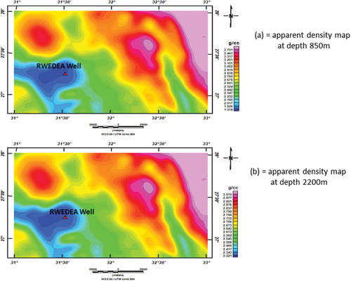
Figure 6. 2D aeromagnetic and gravity modelling from “P1-P1” to “P4-P4”.
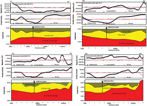
Figure 7. Cont. of 2D aeromagnetic and gravity modelling from “P5-P5” to “P9-P9”.
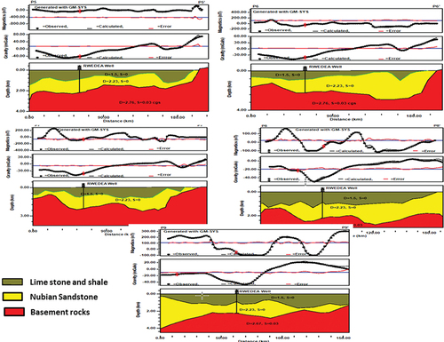
Figure 8. Structure trends determined using (a) the RTP aeromagnetic map and (b) the Euler deconvolution map (SI = 0). (c) Map of the tilt derivative. (d) Map of the analysed area’s first vertical derivative, together with the appropriate azimuth frequency diagram.
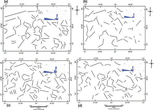
Figure 9. Structure trends as determined by (a) the Bouguer gravity map, (b) the low-pass filter map, (c) the high-pass filter map and the related azimuth frequency diagram.
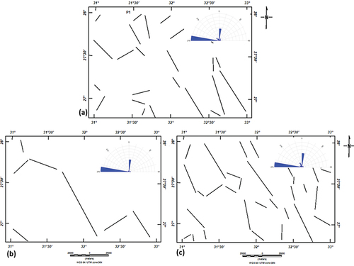
Figure 10. (a) Basement depth map derived from a 2D modelling of aeromagnetic and gravity data; (b) subsurface tectonic map created from the depth to basement map and azimuthal frequency diagram.
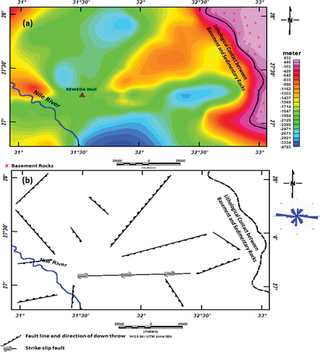
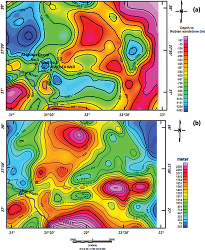
Figure 11. (a) Nubian sandstone aquifer depth map derived from a 2D modelling of aeromagnetic and gravity data. (b) Nubian sandstone aquifer thickness map derived from a 2D modelling of aeromagnetic and gravity data.