Figures & data
Figure 1. Comparison between two satellite images (between August 2004 (A) and November 2004 (B)) from Google Earth® constrains the timing of the construction of the reinforced concrete road.
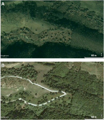
Figure 2. Area of the ground penetrating radar (GPR) measurements along the road. (A) A close-up is shown of the GPR system. (B) The satellite image with the investigated area (grey rectangle).
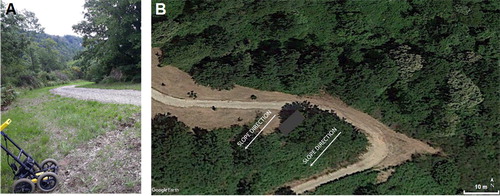
Figure 3. Three radargrams show roughly the area of a geological layer (red) at various depths around 2 m and interface between this layer and the curve roof of the subsurface cave (yellow).
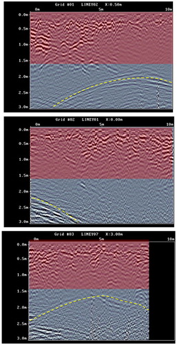
Figure 4. (A) The anomaly due to a possible body (green) is clearly below the roof. The depth is owing to a velocity of 0.10 m/ns of the above rough geological layer and is valid to a depth of 2 m. (B) The corresponding depth-slice in which the geometry of the cave (circled) and, in green/yellow, the same anomaly detected by the radargram are clear. The cave entrance was not covered by the ground penetrating radar (GPR) investigation.
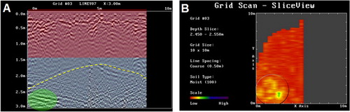
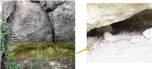
Figure 5. Images show how difficult it was to detect the entrance to the cavity. The magnified image on the right illustrates the inner part of the cavity beyond the obstructed access.