Figures & data
Figure 1. Calculated panoramic green cover index (PGCI) values at a human scale using hemisphere-view panoramas (HVPs). (A-C) stitching process of the hemisphere-view panorama (HVP). (D) hemisphere-view panorama equipment, which includes (1) a 360-degree panoramic camera, (2) a laptop as the controller and data receiver, (3) a mobile power source, and (4) a specific tripod. (E) workflow to the calculate PGCI value
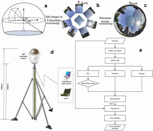
Table 1. Areas of the four functional types in 2013, 2015 and 2018
Table 2. Descriptive information of 12 typical quadrats in Xicheng District
Figure 2. Distribution map of samples and quadrats in Xicheng District, Beijing
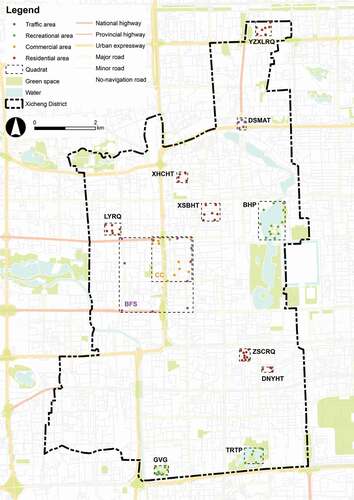
Figure 3. Land surface temperature (LST) and normalized difference vegetation index (NDVI) maps of Xicheng District. (A) LST map; (B) NDVI map
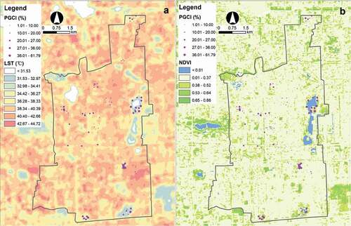
Figure 4. Green vegetation segmentation results and ground truth: I original HVP pictures; II initial segmentation results; III refined segmentation results; IV ground truth. The area in the red circle is variable Areac in formula (1), which is called the effective area of the HVP
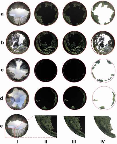
Figure 5. Statistics and spatial distribution of the panoramic green cover index (PGCI) in the study area. (A) histogram plot of all 97 sample points; (B) histogram plots of 4 functional areas; (C) distribution map of PGCI values at the point and quadrat levels. The HVPs of different sample points represent the human-scale cityscape, and the quadrats correspond to the block scale
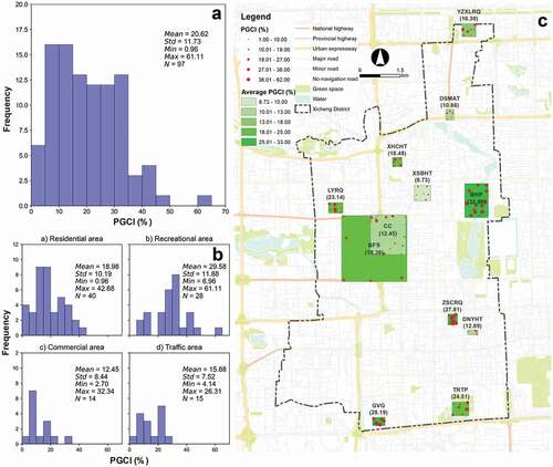
Figure 6. Relationship between panoramic green cover index (PGCI) and normalized difference vegetation index (NDVI)
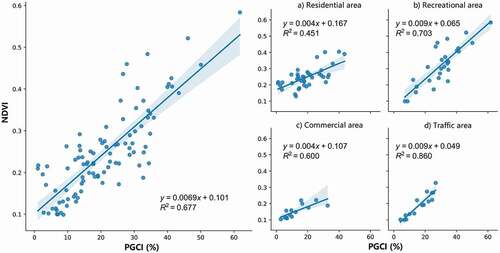
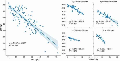
Figure 7. Relationship between panoramic green cover index (PGCI) and land surface temperature (LST)