Figures & data
Figure 1. General view, elevation distribution (m), and location of the Shazand Watershed in Markazi Province, Iran.
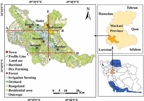
Table 1. The characteristics of the Landsat image used in the present study
Table 2. Land-use distribution (km2) from 1986 to 2016 for the Shazand Watershed, Iran
Figure 2. Land-use maps in study years in the Shazand Watershed, Iran.
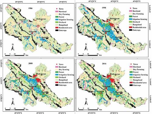
Table 3. Mean values of study indices of NI, NDWI, NDBI, and LST in node years in the Shazand Watershed, Iran
Figure 3. Spatiotemporal distribution of NDVI in study years in the Shazand Watershed, Iran.
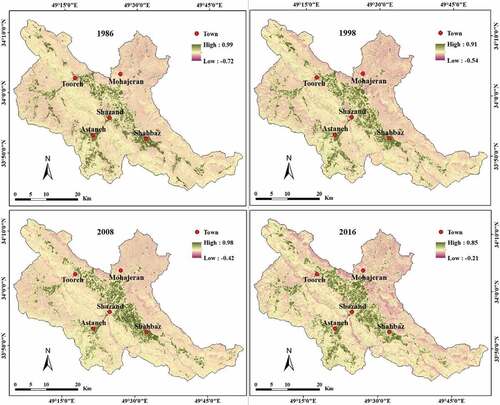
Figure 4. Spatiotemporal distribution of NDBI in study years in the Shazand Watershed, Iran.
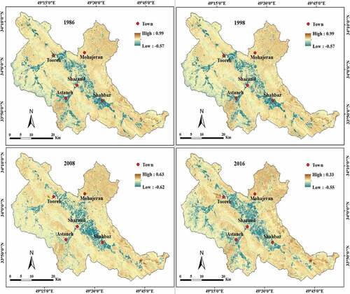
Figure 5. Spatiotemporal distribution of NDWI in study years in the Shazand Watershed, Iran.
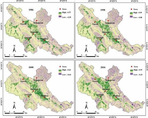
Figure 6. Spatiotemporal distribution of LST (◦C) in study years in the Shazand Watershed, Iran.
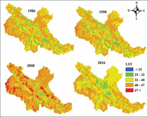
Table 4. Estimated LST (°C) and corresponding ground-based data for study stations in the Shazand Watershed, Iran
Table 5. Relationships between LST and NDVI, NDBI, and NDWI in 1986, 1998, 2008, and 2016 based on 10,000 random points
Table 6. LSTs (◦C) in different land-uses and study years in the Shazand Watershed, Iran
Figure 7. The average rainfall of the stations located in the watershed for the period 1986–2016.
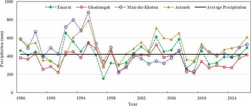
Figure 8. Variations of LST, NDVI, NDBI, and NDWI along with the transect AB (, bottom-right) for 2016 in the Shazand Watershed, Iran.
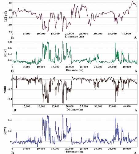
Figure 9. Variations of LST, NDVI, NDBI, and NDWI along the transect CD (, bottom-right) for 2016 in the Shazand Watershed, Iran.
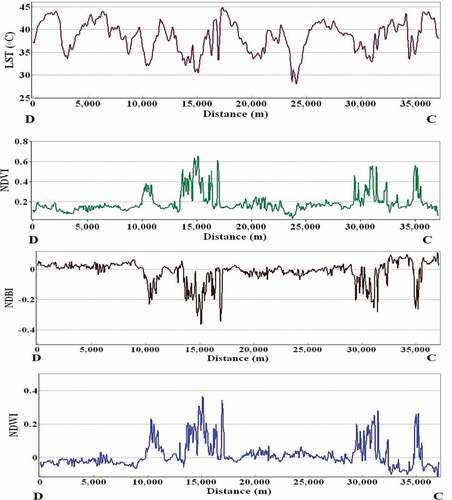
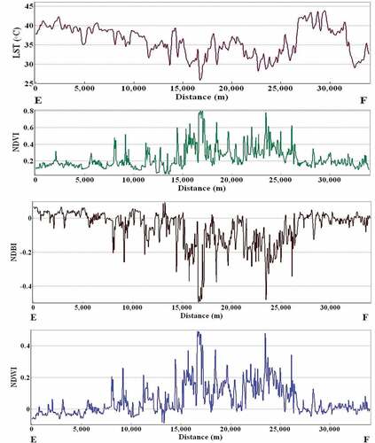
Figure 10. Variations of LST, NDVI, NDBI, and NDWI along the transect EF (, bottom-right) for 2016 in the Shazand Watershed, Iran.