
Figures & data
Figure 1. Start and end events (a) Start event (b) End event
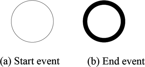
Figure 2. Sequence flow and task (a) Sequence flow (b) Task
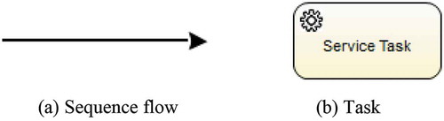
Figure 3. Layered diagram of the common HPCG platform based on workflow services
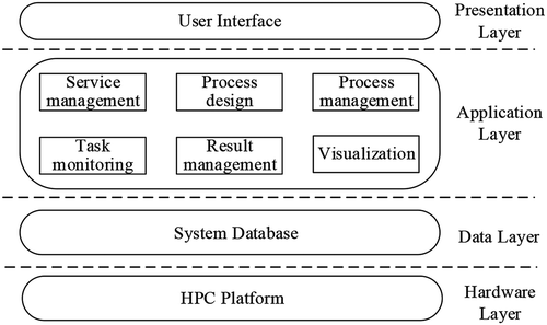
Figure 4. Dependency graph of the modules in the application layer
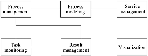
Figure 5. Diagram of the operation sequence
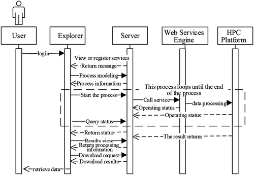
Figure 6. Overall architecture of the system
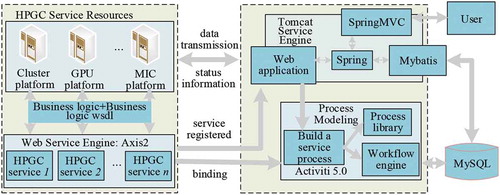
Figure 7. General serial algorithm service encapsulation and publishing mode
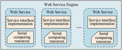
Table 1. Detailed configurations of the experimental platforms
Figure 8. General parallel algorithm encapsulation and publishing mode
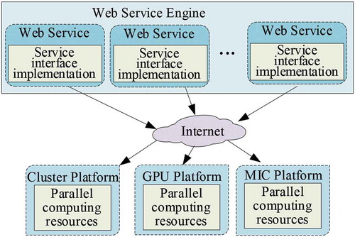
Figure 9. Publishing structure of spatial information algorithm service
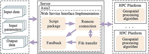
Figure 10. Class diagram of geospatial information algorithm web service publishing
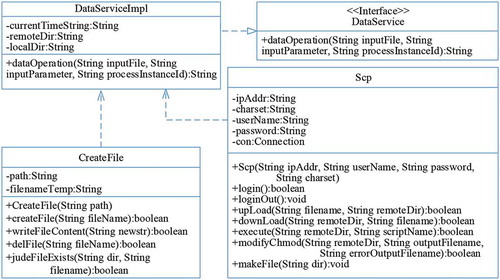
Figure 11. General steps for the experimental DEM application
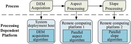
Figure 12. Technical implementation of the experimental DEM processing application
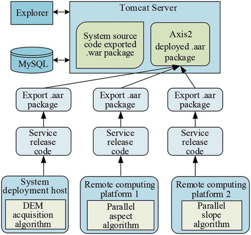
Figure 13. Sketch map for obtaining longitude and latitude by polygon abstraction
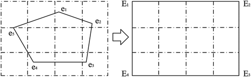
Figure 14. Flow chart of GDEM data acquisition
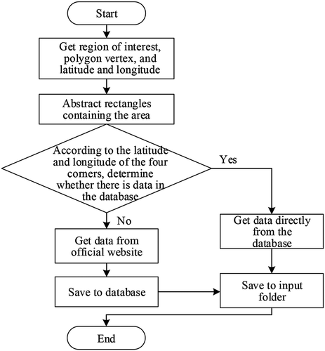
Figure 15. Structure chart of the parallel slope algorithm
Figure 16. Parallel structure of the aspect algorithm based on OpenMP
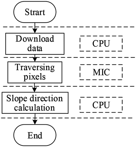
Figure 17. Platform deployment diagram
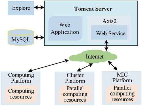
Figure 18. Process modeling diagram
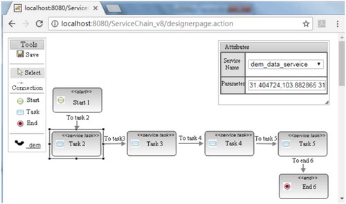
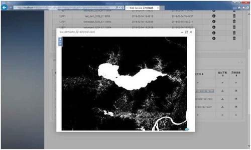
Figure 19. Preview of the processing results with workflow-based platform
Data availability statement
The data that support the findings of this study are available from the corresponding author upon reasonable request.