
Figures & data
Figure 1. GeoSOT subdivision theory and grid code
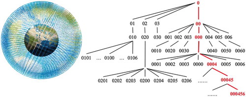
Figure 2. The Z-order filling curve of GeoSOT grid code
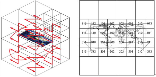
Figure 3. Spatio-temporal grid index structure
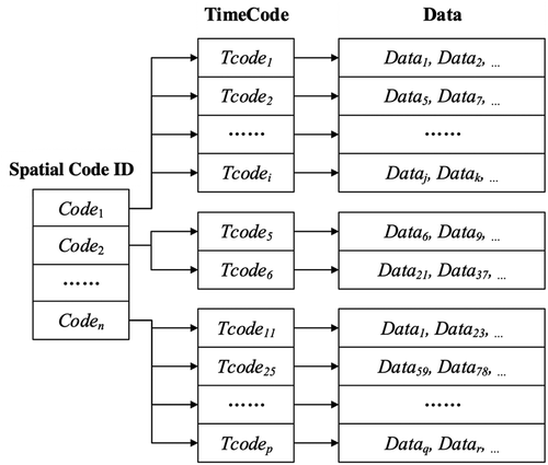
Figure 4. Example of grid-level selection
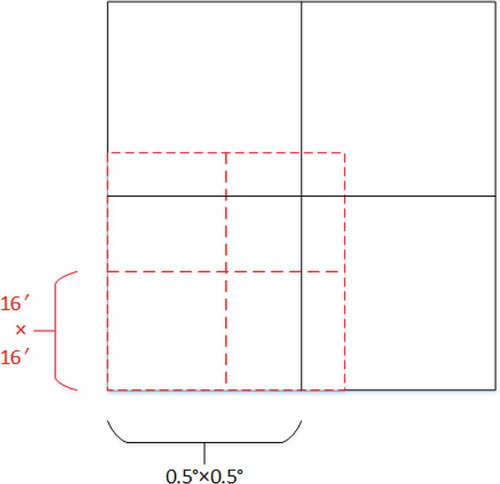
Table 1. Metadata table structure
Table 2. Hardware environment configuration
Table 3. Software environment configuration
Table 4. Range query experiments in different time ranges (unit: ms)
Figure 5. STGI vs “lat_lon_height+time.”
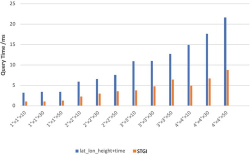
Figure 6. STGI vs primary index model
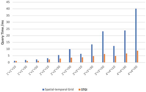
Figure 7. Query time ratios of two index models
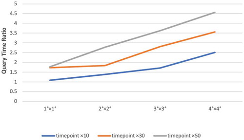
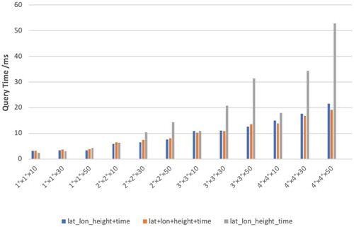
Figure 8. Comparisons of index models with different levels
Supplemental material
Supplemental Material
Download MS Word (32.1 KB)Data availability statement
For the moment, the data from the project are not publicly available. The data that support the findings of this study will be available on request from the authors.