
Figures & data
Figure 1. Distribution of ocean science data acquired in the past decade, based on publicly available data from the internet.
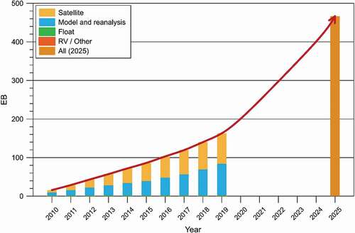
Figure 2. Distribution of ocean science data acquired in the past decade, based on publicly available data from the internet. Small ocean science data (from buoys, ship surveys, etc.) are in blue; big oceanographic data (from satellites, models and reanalysis data) are in orange.
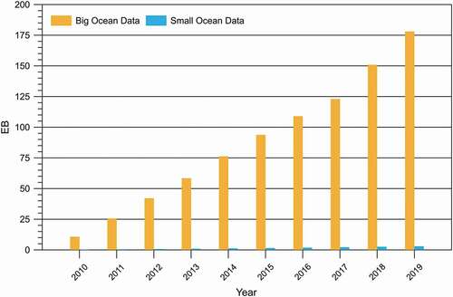
Figure 3. Distribution of ocean science data acquired in the past decade, based on publicly available data from the internet. Deep ocean data (from buoys, deep submersibles, partial models and reanalysis) are in blue; surface data (from satellites, ships, partial models and reanalysis) are in orange.
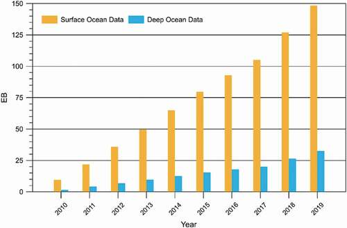
Table 1. List of satellites launched by selected countries in the past decade.