
Figures & data
Figure 1. (a) The location of Chania prefecture; (b) Distribution of the most significant known archeological sites of Chania prefecture.
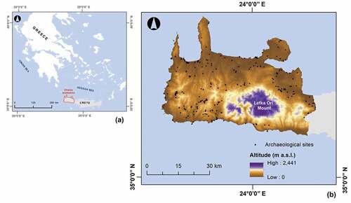
Table 1. Summary of spatial datasets used in this study.
Figure 2. Erosion-influencing factors analyzed in USPED model (a) K-factor (b) C-factor (c) P-factor (d) R-factor (e) LST-factor.
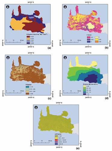
Figure 3. Spatial extent of soil loss and deposition rates for Chania prefecture.
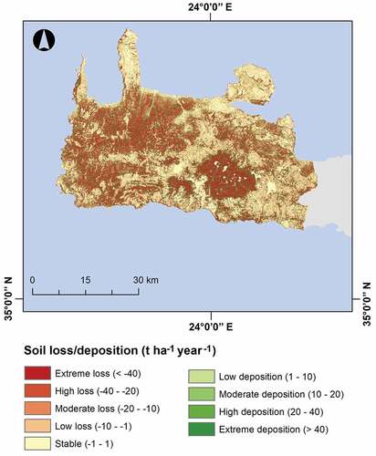
Figure 4. Correlation of the soil loss and deposition classes with coverage area percentages for Chania prefecture.
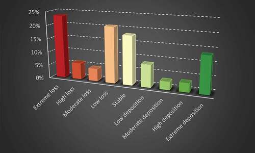
Figure 5. Spatial extent of soil loss and deposition rates (a) For the location (b) For the vicinity (buffer zone area) of archaeological sites.
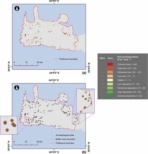
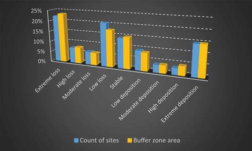
Figure 6. Correlation of the soil loss and deposition classes with archaeological site count and buffer zone area percentages.
Data availability statement
The data that support the findings of this study are available from the corresponding author, C.P., upon reasonable request.