Figures & data
Table 1. Characteristics of districts studied
Figure 1. Selected districts in the state of Karnataka, India, with information on the agroclimatic zones and HDI.
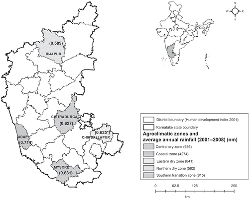
Table 2. LUF and indicator FoPIA
Table 3. Scenarios for the PIA
Figure 2. Mean weightage attributed to LUFs by participant groups.
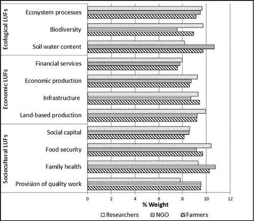
Table 4. Mean weightage attributed to each LUF by participants in the study districts
Figure 3. Organic input use scenario (S1) impact scores on indicators assigned by participant groups.
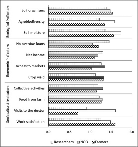
Figure 4. Mixed input use scenario (S2) impact scores on indicators assigned by participant groups.
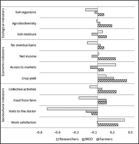
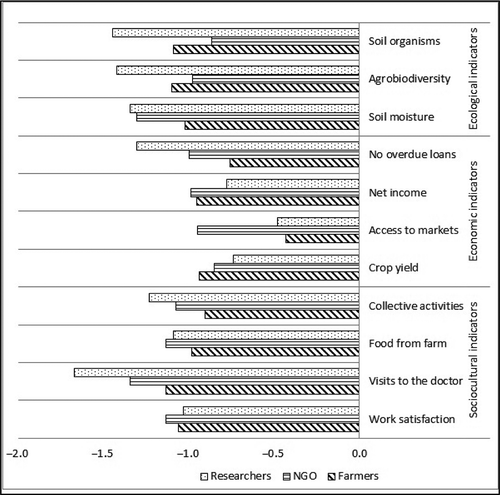
Figure 5. Conventional input use scenario (S3) impact scores on indicators assigned by participant groups.