
Figures & data
Figure 1. Location of the study area, types of vegetation, land use and its conservation status according to the INEGI classification (series VI, 2017), modified for this study. Reference: Land use from National Institute of Statistic and Geography, 2017.
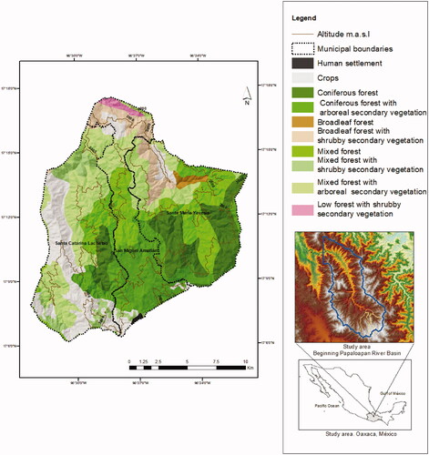
Figure 2. Result of the Tasseled cap analysis with minimum and maximum values for brightness, greenness, and humidity and mean and standard deviation values for brightness, greenness and humidity. CF: coniferous forest; MF: mixed forest; BF: broadleaf forest; CFSArb: coniferous forest with arboreal secondary vegetation; MFSArb: mixed forest with arboreal secondary vegetation; MFShr: mixed forest with shrubby secondary vegetation; BFShr: broadleaf forest with secondary shrub vegetation; LFShr: low forest with secondary shrub vegetation; Crops: crops; HS: human settlement.
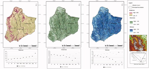
Figure 3. Result of vegetation indices with minimum and maximum values for DVI, NDVI, SAVI, MSAVI and MSI and Mean and standard deviation values for the applied vegetation indices. CF: coniferous forest; MF: mixed forest; BF: broadleaf forest; CFSArb: coniferous forest with arboreal secondary vegetation; MFSArb: mixed forest with arboreal secondary vegetation; MFShr: mixed forest with shrubby secondary vegetation; BFShr: broadleaf forest with secondary shrub vegetation; LFShr: low forest with secondary shrub vegetation; Crops: crops; HS: human settlement.
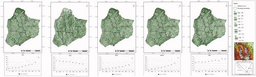
Table 1. R values by texture filter and 9 × 9 and 11 × 11 windows for green band and infrared band.
Table 2. Component score coefficient table.
Figure 4. Spatial representation of the canopy opening (original data).
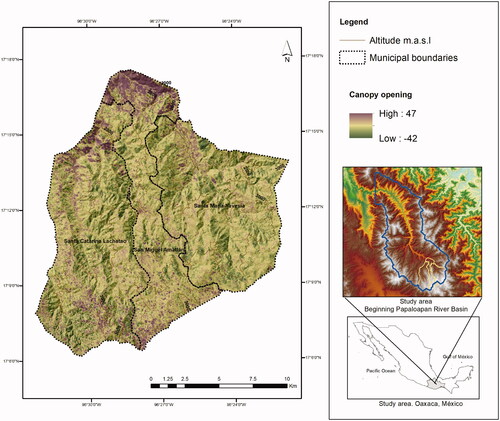
Figure 5. Spatial representation of the canopy opening, a result of the map algebra process.
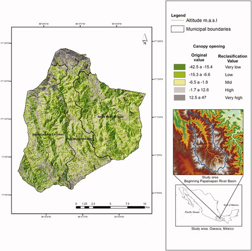
Figure 6. Percentage of canopy opening by vegetation type. AH: Human settlement; Crops: crops; CF: coniferous forest; CFArb: coniferous forest with secondary arboreal vegetation; BF: broadleaf forest; BFShr: broadleaf forest with shrubby secondary vegetation; MF: mixed forest; MFArb: mixed forest with secondary arboreal vegetation; MFShr: mixed forest with secondary shrub vegetation and LFShr: secondary low forest with secondary shrub vegetation.
