
Figures & data
Figure 1. The network of central places, 1973.
Source: The National Planning Office (Citation1976).
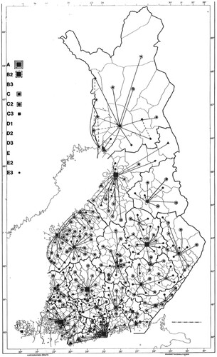
Figure 2. The roles and hierarchical statuses of the cities and regions in the spatial imaginaries of Finnish political elites.
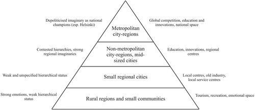
Figure 1. The network of central places, 1973.
Source: The National Planning Office (Citation1976).
Figure 2. The roles and hierarchical statuses of the cities and regions in the spatial imaginaries of Finnish political elites.