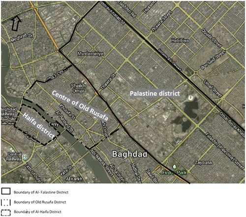
Figures & dataFigure 1. Map of the case study areas.Source: Annotations by the authors on a base map sourced from Google Maps.Display full sizeTable 1. Comparison of the case study areas.Download CSVDisplay TableTable 2. Housing tenure status.Download CSVDisplay TableTable 3. Household size.Download CSVDisplay TableTable 4. Methods used to accommodate families.Download CSVDisplay TableTable 5. Change in meeting places.Download CSVDisplay TableTable 6. Transportation route changes after 2003.Download CSVDisplay TableTable 7. Number of cars owned.Download CSVDisplay TableTable 8. Travel Mode for district (neighbourhood) shopping/personal business.Download CSVDisplay TableTable 9. Pearson chi-square results.Download CSVDisplay Table