Figures & data
Figure 1. Shrinking cities in Portugal between 1991 and 2011, as calculated based on census data.
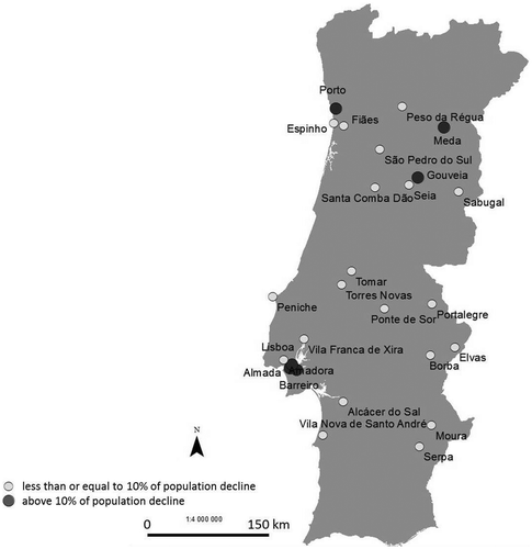
Figure 2. Rates of population growth and decline of the cities of the Metropolitan Area of Oporto between 1991 and 2011, as calculated based on census data.
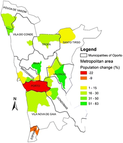
Figure 3. Location of Barreiro city and access routes between Barreiro and Lisbon.
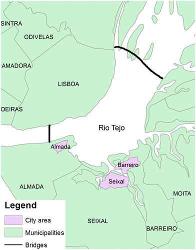
Figure 4. Geographic distribution of insolation in Portugal with respect to the locations of various inland and coastal cities. Source: Environment Atlas (http://sniamb.apambiente.pt/webatlas/).
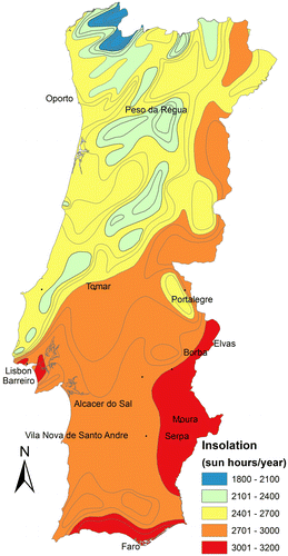
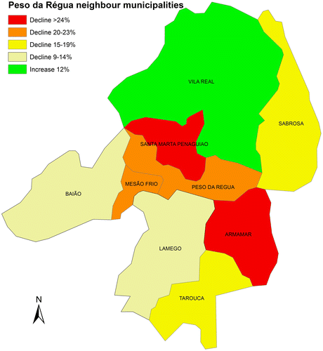
Figure 5. Rates of population change between 1991 and 2001 in Peso da Régua and neighbouring municipalities, as calculated based on census data.