
Figures & data
Figure 1. Location of Lake Tana Basin.
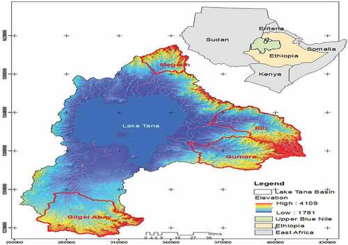
Table 1. Kappa coefficient agreement
Table 2. Confusion matrixes for the classification of 1986
Table 3. Summary of accuracy assessment from 1986–2018 (%)
Figure 2. Land use land cover map of 1986 and 2002 of the Tana basin.
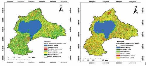
Figure 3. Tana basin land cover map of 2018.

Table 4. Summaries of land cover classes in the Tana basin from 1986–2018