Figures & data
Figure 1. Sampling location.
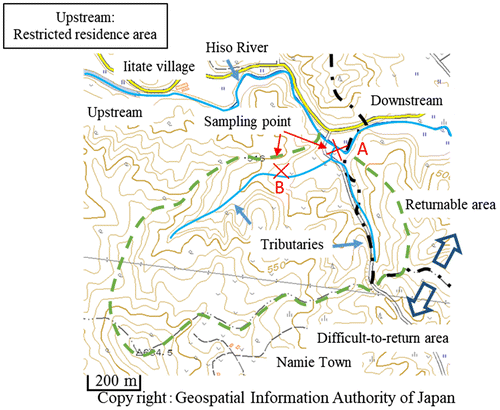
Figure 2. Sedimentary layer.
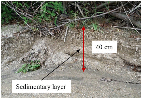
Table 1. Dates when rainfall in Iitate village exceeded 50 mm/day
Figure 3. Schematic diagram of the sampling pipe and the pipe guide holder.
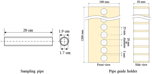
Figure 4. Sampling soil from the sedimentary layer at Point A.
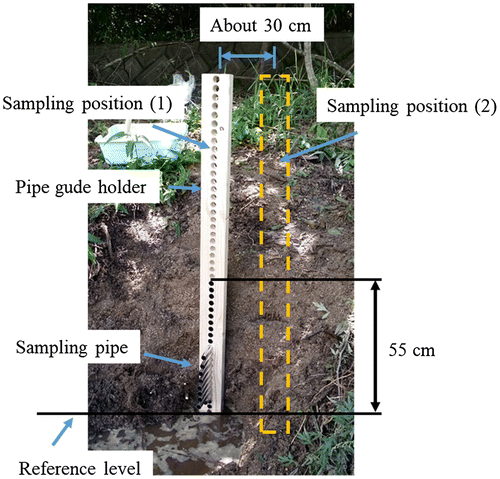
Figure 5. Radioactivity as a function of height with respect to the reference level.
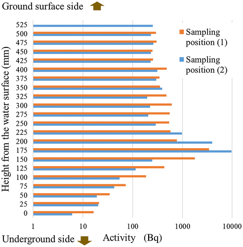
Figure 6. Radioactivity of the soil samples transported from the mountain in the difficult-to-return-to area (A) and from the restricted residence area (B).
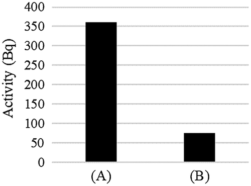
Figure 7. volumeand radioactivity of the soil samples as a function of soil particle diameter for sampling positions (1) and (2).
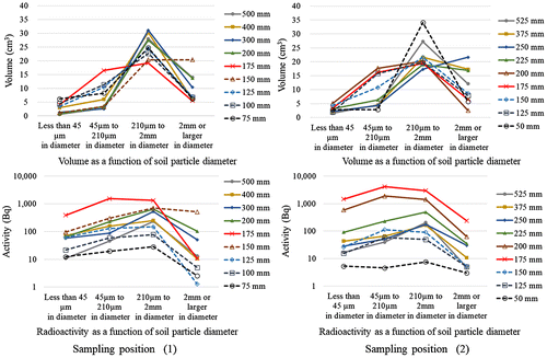
Figure 8. Soil sample volumeas a function of soil particle diameter from the sediment formed before the earthquake (75 mm) (a), the sediment formed right after the earthquake (175 mm) (b), the sediment formed after the earthquake (500 mm) (c), and the soil sample from Point B (d).
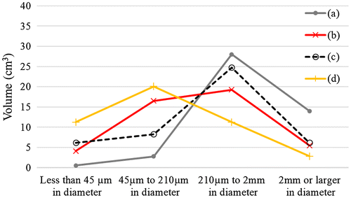
Figure 9. The volumeand radioactivity distributions as a function of particle diameter for the samples from the sedimentary layer, the soil samples transported from the mountain on 22 August 2016, and from the restricted residence area upstream of Hiso River.
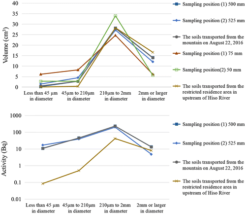
Figure 10. The particle size distributions of the particles of mountain soil from Point B with diameters less than 45 μm, sediment particles with diameters less than 45 μm from a height of 500 mm at sampling position (1), and samples precipitated from the water of Hiso River.
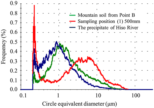
Figure 11. Specific radioactivity of mountain soil from Point B, sediment from a height of 500 mm at sampling position (1), and precipitate from Hiso River.
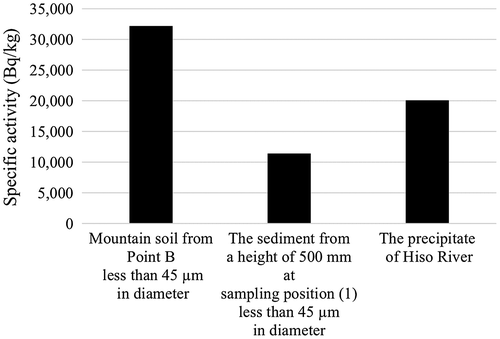
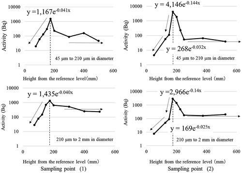
Figure 12. Radioactivity as a function of height in the sediment layer for particles with diameters in the ranges of 45 to 210 μm and 210 μm to 2 mm from sampling positions (1) and (2).