
Figures & data
Figure 1. Location map study area (Yirgalem, Town Ethiopia).
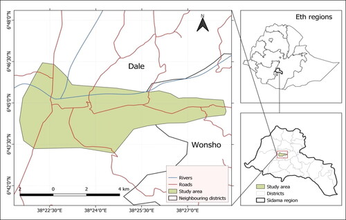
Table 1. Thematic layers used for potentially suitable landfill site selection, their sources, and details.
Figure 2. General procedures followed in selecting a solid waste dumping suitable site.
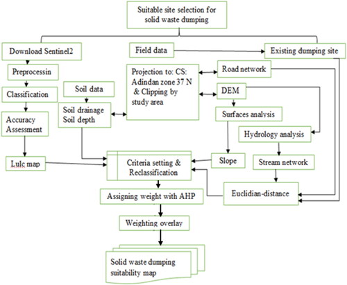
Table 2. Suitability criteria (standard).
Table 3. Scale of relative importance for the pairwise comparison.
Table 4. The mean random index value (RI) (adapted from Saaty, Citation1980).
Table 5. Pair-wise comparison matrix, factor weights, and consistency ratio of factors.
Figure 3. Suitability criteria based on reclassified distance from the road network.
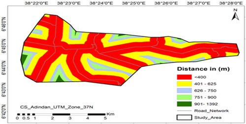
Figure 4. Suitability criteria based on reclassified distance from stream network.
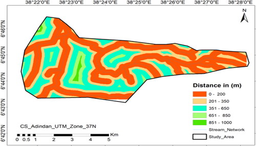
Figure 5. Suitability criteria based on reclassified distance from the built up of the residential area.
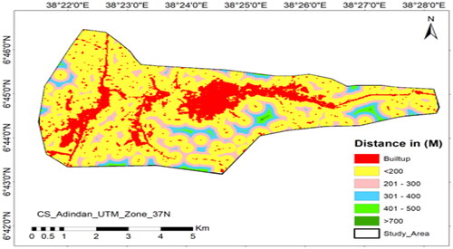
Table 6. Land use land cover area.
Figure 6. Suitability criteria based on reclassified distance from the built-up of the residential area and land cover land use maps.
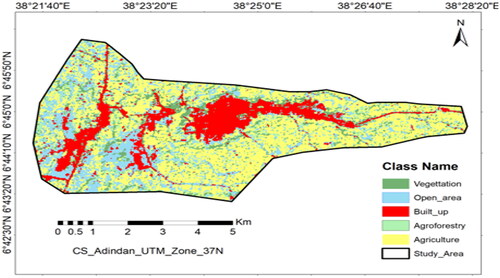
Table 7. Accuracy assessment (error matrix) reports of the classification maps for the study years.
Figure 7. Suitability criteria based on reclassified slope and elevation.
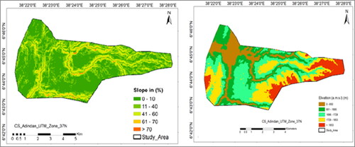
Figure 8. Suitability criteria based on reclassified soil texture and Soil depth maps.
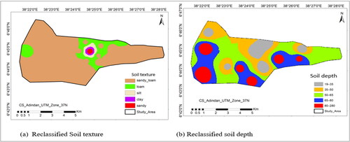
Figure 9. Suitability criteria based on reclassified distance in meters from the existing dumping site and view shade from built-up residential area maps.
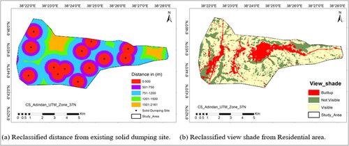
Figure 10. Solid waste disposal site suitability Map of Yirgalem Town. NB: S3-highly suitable, S2-moderately suitable, S1-marginally suitable, N2-not suitable, and N1-permanently not suitable.
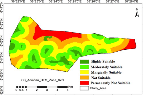
Table 8. Statistical analysis of the solid waste disposal site suitability.
Figure 11. Validation of model using the area under curve (AUC).
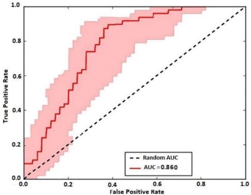
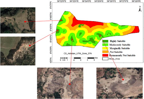
Figure 12. Validation of landfill suitable site with Google Earth.
Data availability statement
The data used to support the findings of this study are available from the corresponding author upon request.