Figures & data
Figure 1. Spatial distribution of sample peasant administration processed in Arc GIS 10.2.
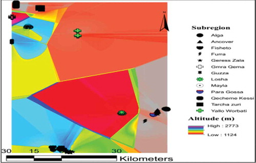
Table 1. Land-cover area (ha) of agricultural land use in peasant administration (PA)
Table 2. Chi-square (χ2) multiple comparison tests on agricultural land-cover area of the farm enterprises in peasant administration
Table 3. Family and farm size, and livestock herd head of the households in peasant administration (mean and standard deviation [SD])
Table 4. Overall (mean and standard deviation [SD]) distance (minute) from the peasant administration to market type
Table 5. Overall (mean and standard deviation [SD]) distance (minute) among agroecological zone (AEZ) and market type in peasant administration
Table 6. Elevation (m) tracked during field survey and landscape slope (%) processed in Arc GIS 10.2 in agroecological zone (mean and standard deviation [SD])
Table 7. Dominant farming system characterized in smallholder mixed crop–livestock systems in agroecological zone (AEZ) and peasant administration (PA)