Figures & data
Figure 1. Location map of the study area (own source).
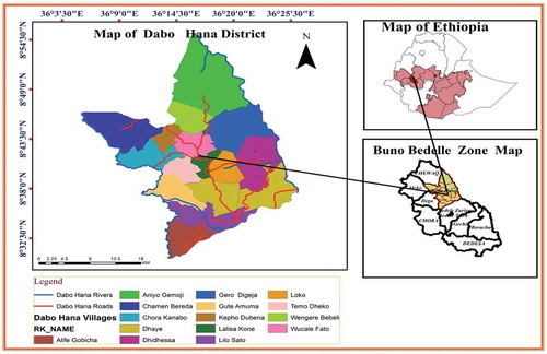
Table 1. Cereal crop production of 4 years of yield/quintal
Table 2. Data types and sources
Table 3. Cereal crop environmental requirements at different suitability classes
Table 4. Scale of rating influence of factors (Saaty, Citation2002)
Figure 2. Socio-environmental data suitability (a) Land-use land cover (b) Temperature (c) Rainfall (d) Altitude (e) Slope (f) Soil property (g) Soil (h) Market proximity (i) Road proximity.
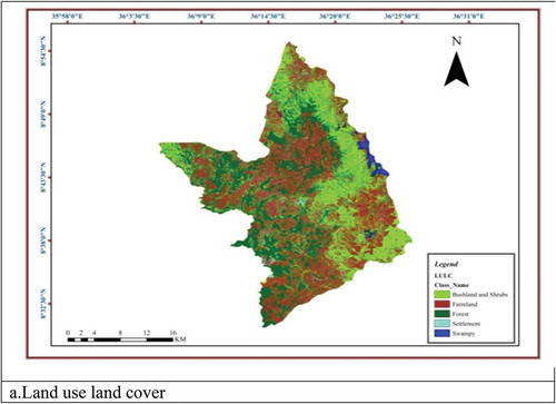
Figure 2. (Continued).
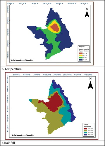
Figure 2. (Continued).
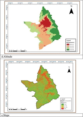
Figure 2. (Continued).
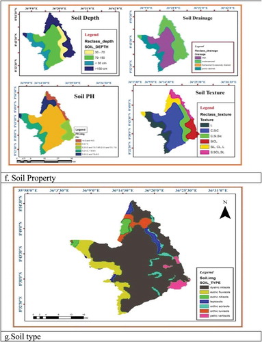
Figure 2. (Continued).
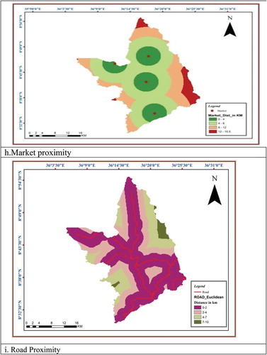
Figure 3. Map of cereal crops land suitability in Dabo Hana district. (a) Teff (b) Wheat (c) Barley (d) Maize.
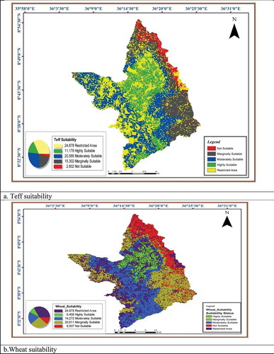
Figure 3. (Continued).
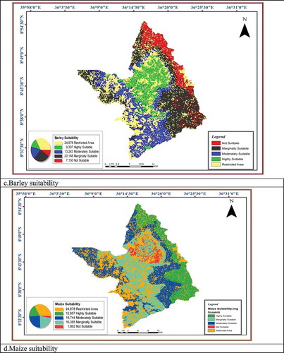
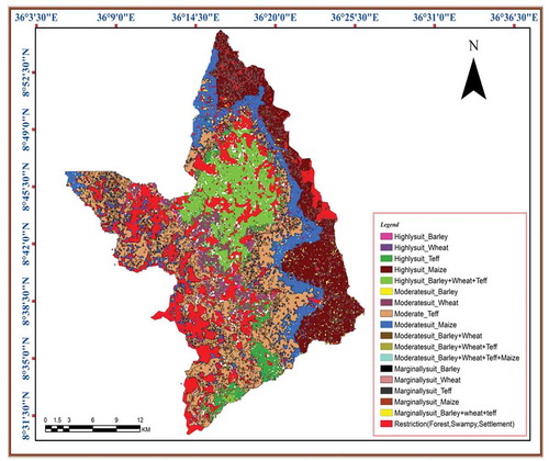
Figure 4. Map of optimum land suitability allocation for major cereal crops in Dabo Hana district.