
Figures & data
Figure 1. Location map of the study micro-watersheds in Becho district of Central highlands of Ethiopia.
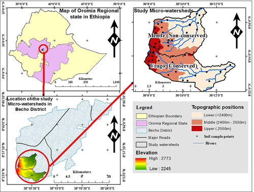
Figure 2. Rainfall and temperature records of the study area based on the records of nearby Tulu Bolo station (1990–2019) (Source: Ethiopian Meteorological Institute, 2021).
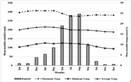
Table 1. Effects of land-use types and topographic positions on soil physical properties (mean ± standard error) in selected micro-watersheds of the Central Highlands of Ethiopia.
Table 2. The interaction effect of topographic position and land use type on soil physico-chemical properties in selected micro-watersheds of the Central Highlands of Ethiopia.
Table 3. Effects of land-use types and topographic position on soil pH, EC, SOC, TN, C:N ratio, and Av. P (mean ± standard error) in selected micro-watersheds of the Central Highlands of Ethiopia.
Table 4. Pearson correlation coefficients between soil properties in 0–30 cm depth in the studied micro-watersheds.
Table 5. Effects of land-use types and topographic positions on soil CEC, exchangeable base cations, and PBS (mean ± standard error) in selected micro-watersheds of the Central Highlands of Ethiopia.
Data availability statement
The corresponding author in this study is willing to provide the generated and analysed data upon reasonable request.