
Figures & data
Figure 1. Conceptual Framework.
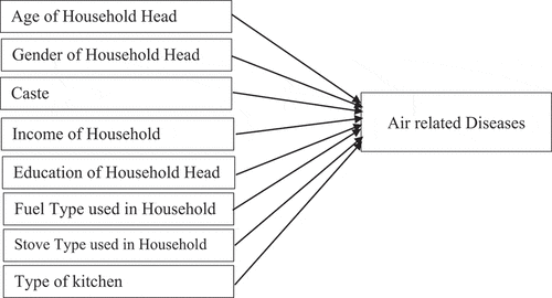
Table 1. Households’ fuel use in rural and urban areas
Table 2. Household fuel use by income category
Table 3. Distribution of households for kitchen types
Table 4. Vehicular flow per day by locations
Table 5. Average distance traveled by the surveyed vehicles
Table 6. Carbon monoxide released by vehicles in the survey locations (in gm/day)
Table 7. Hydrocarbon Released by Vehicles in the Surveyed Locations (in gm/day)
Table 8. Nitrogen Oxide Released by Vehicles (in gm/day)
Table 9. Particulate Matter Released by Vehicles (in gm/day)
Table 10. Location-wise Total Emission Load of Counted Vehicles (in gm/day)
Table 11. Category-wise total emission load of surveyed vehicles (in gm/day)
Table 12. Persons affected by air-related diseases in the study location
Table 13. Age of Persons Affected by Air-related Diseases
Table 14. Air-related diseases affected by gender
Table 15. Distribution of air-related disease affected persons by caste
Table 16. Distribution of air-related disease-affected persons by education
Table 17. Distribution of air-related disease-affected persons by household income
Table 18. Prevalence of air-related diseases by fuel category (%)
Table 19. Prevalence of air-related diseases by kitchen types (%)
Table 20. Correlation
Table 21. Regression Coefficients