Figures & data
Figure 1. Part of the 5875/1 sheet of the Third Military Survey (1869), south from Braşov, 1:25,000 scale.
Figure 2. The mapped area of the 1:200,000 scale derived maps of the Third Military Survey.
Figure 3. The 4861 sheet (1:75,000 scale) published in 1933. We can recognise that the relief representation on the Czechoslovakian part (the larger, NW part of the inset) is still shown with Lehmann hachures, while on the Hungarian section (SE part of the inset) the relief is represented by contour lines. The whole content on the Czechoslovakian side (including the lettering) based on the Third Military Survey.
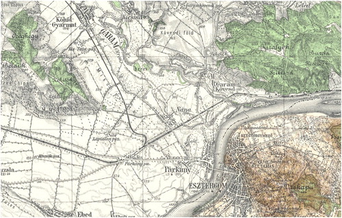
Figure 4. Example (5270/Ny) of the 1:50,000 scale series (1940–1944). The Transylvanian sheet is a good example of the different levels of update. The maps of the out-of-Hungary areas were just copied from the Third Military Survey 1:75,000 scale maps with few updates (however, the relief is still represented by hachuring). The red line shows the demarcation line, which was specified on the basis of the Vienna Award of 1940, though not marked on the terrain.
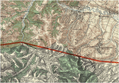
Figure 5. The relevant part of the orienteering map Kőszeg (Király-völgy), 1994 (1:10,000 scale). The NW part of the inset belongs to Austria. Traces of the former border barrier are also visible (a diagonal line parallel to the border section).
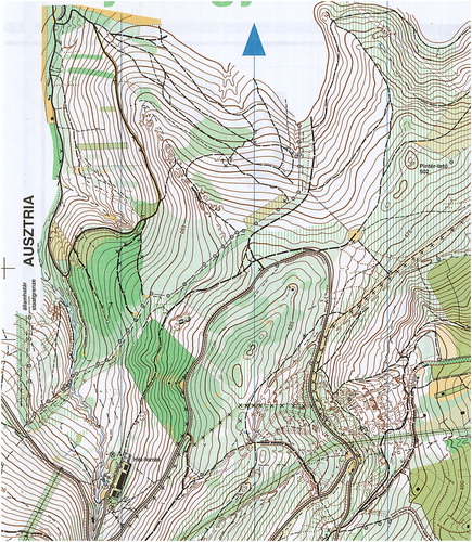
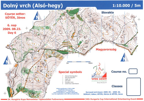
Figure 6. A 2009 orienteering map along the Hungarian–Slovakian border. The thin yellow line is the narrow ride (clearance) of the border.