Figures & data
Figure 1. Exercise asking pupils to recognize objects on an aerial image and a map, in a textbook for 7th grade in Azerbaijan (Qəribov et al., Citation2014).
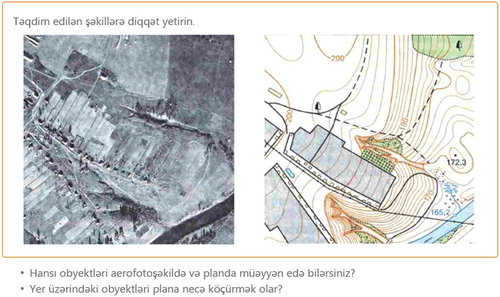
Figure 2. Exercise asking 7th grade pupils to measure the length of Caspian Sea from North to South on maps at different scales and discuss the reasons of the differences in the results (Qəribov et al., Citation2014).
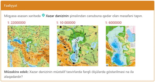
Figure 3. Illustrations explaining methods for the representation of relief in a Hungarian textbook for 5th grade (Kropog et al., Citation2016a).
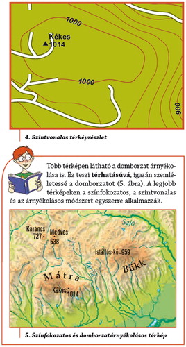
Figure 4. Teaching geographic coordinate system and cross-section in a Hungarian school atlas (Földrajzi Atlasz, Citation2017)
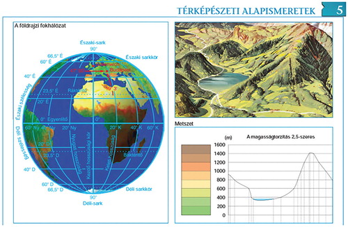
Figure 5. Above: Earthquakes in Haiti and Japan (Əlizadə et al., 2013). Below: Regions exposed to earthquakes in Azerbaijan (Məmmədova & Mahmudova, Citation2017), as showed in the textbooks.
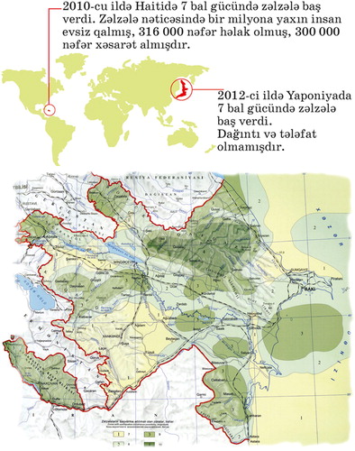
Figure 6. Initial page of the chapter dedicated to geographic names in the textbook for 4th grade, asking pupils to answer questions about the places of an imaginary mountain race (Benkőné Nyirő et al., Citation2016).
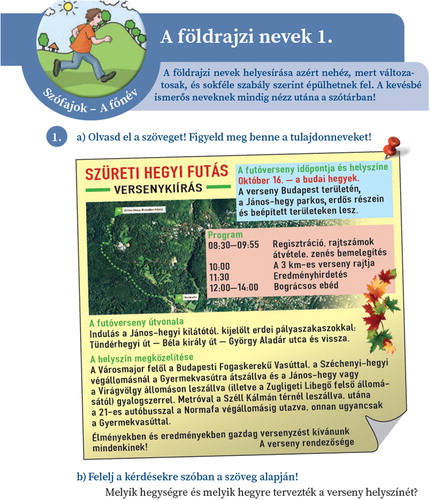
Figure 7. UAE map representing the main sea ports from the Social Studies textbook for grade 5 (Ministry of Education, Citation2017).
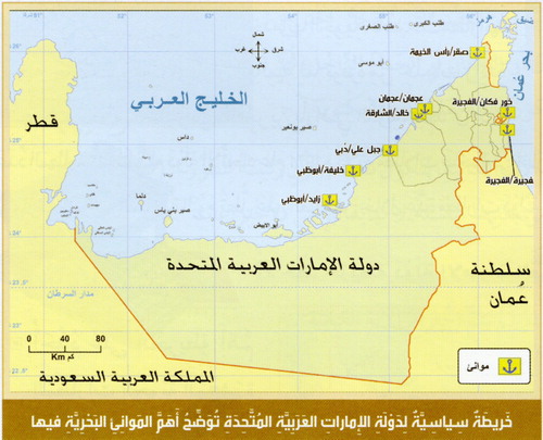
Figure 8. Exercise asking 6th grade pupils to calculate the distance between two points considering the scale (Əlizadə et al., 2013).
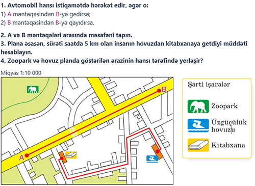
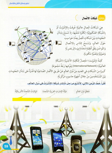
Figure 9. Page of the text book for 5th grade pupils explaining the use of new technologies (Ministry of Education, Citation2017).