Figures & data
Figure 1. Carto-synaesthesia? Land Use Survey ‘Heath, Moorland, Commons and rough pasture’.
Figure 2. The author’s teaching and research field sites at Broad Down and the location of key elements the Riddley Walker narrative (extract from Sheet TR04).
Figure 3. Hinxhill: Old English ‘Haenostesyle’ – hill of the stallion or man named Hengist (extract from Sheet TR04).
Figure 4. Spider’s Castle, now demolished and cress-beds close by are no longer on recent OS map series; brickworks and clay pit to the south of Spider’s Castle (extract from Sheet TR04).
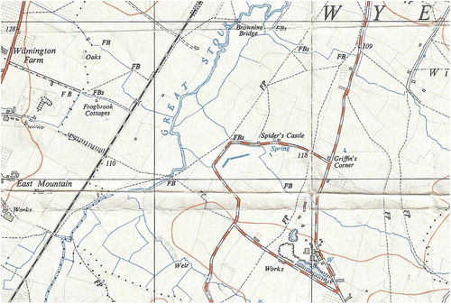
Figure 5. An ancient trackway leads from the village of Wye to a chalk pit and the Wye Crown, a symbol carved in the chalk hillside to celebrate the coronation of George VII in 1902 (extract from Sheet TR04).