Figures & data
Figure 1. Aerial photograph of the neighbourhood in the early 1950’s, shortly after its inception (reproduced with permission of the copy right holder, Aerophoto Eelde).
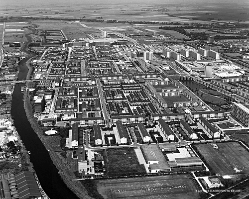
Figure 2. Core challenges in a spatial analysis of the Paddepoel neighbourhood: providing better East-West connections (yellow), reduction of car traffic and connecting fragmented green areas (green), and upgrading underused public spaces (brown); red stars indicate locations rated a highly promising for redesign by the urban designers.
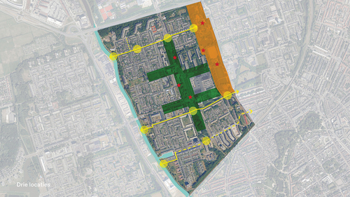
Figure 3. Core challenges in the Paddepoel neighbourhood according to the opinions of experts in public, health and social care, regarding six topics; circles indicate areas of particular concern, lines indicate roads deserving particular attention, and the question mark indicates a general lack of appropriate sites.
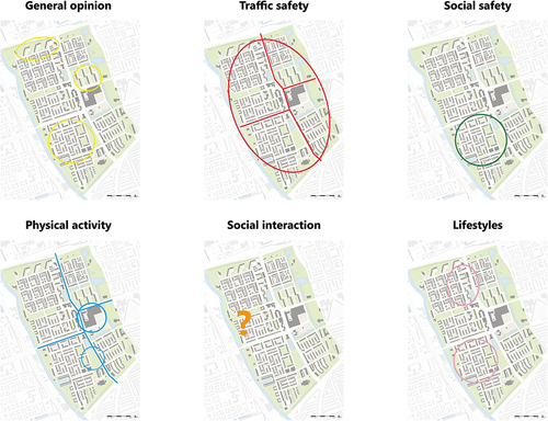
Figure 4. Core challenges in the Paddepoel neighbourhood according to the opinions of residents for themselves and for the minors they took care of; dots represent road crossings and play grounds.
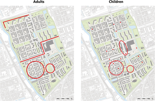
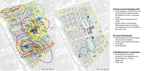
Figure 5. locations selected by the various assessors – each assessor indicated with initials and a colour shared with one other team member (left); priority-location and topics per location are listed on the right.