
Figures & data
Figure 1. (Left) a map of Delapré Park with the locations of the newly installed wayfinding and walking route highlighted. (Right) An example of the wayfinding signs.

Figure 2. Heatmap of the English index of multiple deprivation 2019 within Northampton, England. Black outline shows the location of Delapré Park. Freely used from: https://research.mysociety.org/sites/imd2019/area/la-northampton-borough-council/lsoa/.
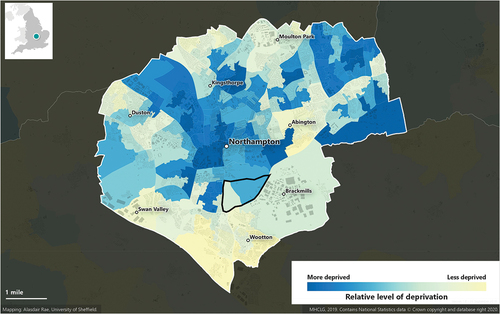
Table 1. Interview participants details.
Table 2. Main and subordinate themes from analysis.
Supplemental material
Supplemental Material
Download MS Word (3.7 MB)Data availability statement
All anonymised data underpinning this article are available upon request.