Figures & data
Figure 1. Locations of the seven subalpine forest sites mapped using sUAS within the Great Basin and Colorado Plateau ecoregions. Map data courtesy of Esri, Garmin, USGS, NOAA, and NPS.
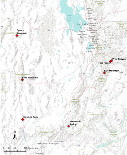
Table 1. Characteristics of the seven subalpine forest sites mapped during this project. Terrain data derived from USGS 3DEP.
Figure 2. DJI Inspire 2 with DJI Zenmuse X4S camera in operation at Highland Peak, Nevada.
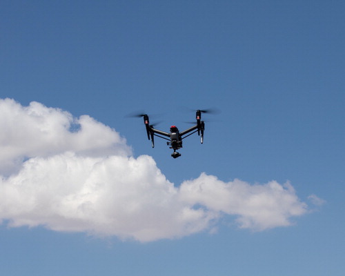
Figure 4. Nadir aerial photograph showing trees along a steep slope (∼55° average). The top-right of the image has a finer scale (higher spatial resolution) than the bottom-left of the image due to the rapidly changing elevation. The changes in elevation are reflected in the relative sizes of the trees.
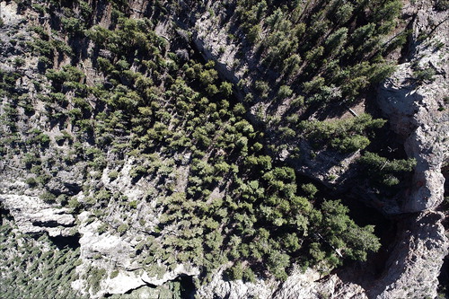
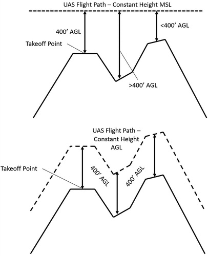
Figure 5. Diagram comparing UAS mapping missions flown at a constant height AGL (above ground level) versus a constant height MSL (above mean sea level). Flight at a constant height AGL (i.e., terrain following) allows the UAS to remain under the 400-foot (122 m) maximum altitude set by the FAA, even while navigating across rugged terrain, and mitigates problems related to variable scale and resolution.