
Figures & data
Figure 1. Study area.
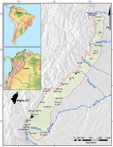
Figure 2. Methodological synopsis.
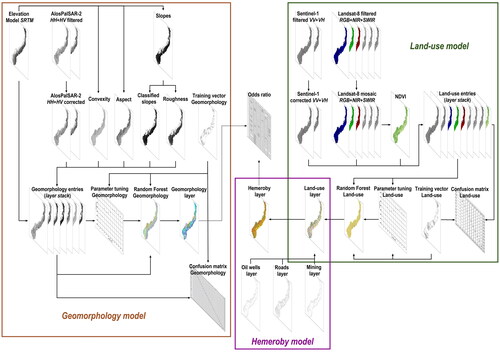
Figure 3. Geomorphological map.
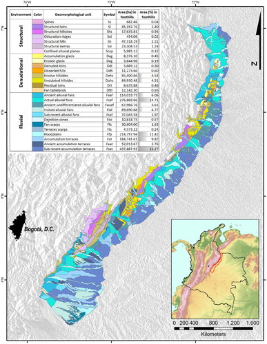
Figure 4. Land-use map.
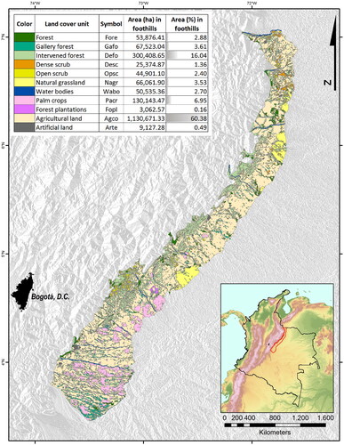
Figure 5. Hemeroby map.
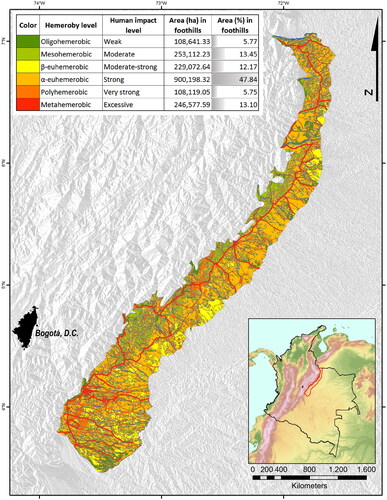
Figure 6. Parametrization of the classifiers Random Forest. (A) For geomorphological model; (B) for land-use model.
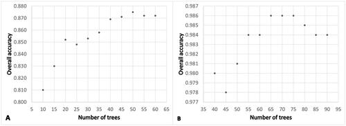
Table 1. Confusion matrix of the geomorphological model.
Table 2. Confusion matrix of the land-use model.
Table 3. Odds ratio between hemeroby and geomorphology of the foothills.