
Figures & data
Figure 1. Localization of the study site. a: Superpáramo sky islands (orange and red areas) in Northern Ecuador. b: Detail of Mt. Corazón in the former map. c: Detail of the summit area (satellite image: ©2020 Google Earth)
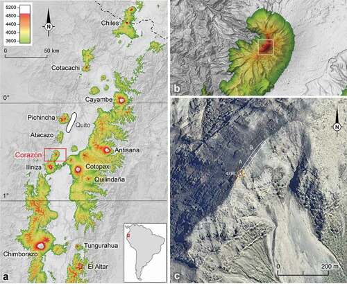
Table 1. List of the vascular plant species encountered in January 2020 within a 0–80 m distance from the summit of Mt. Corazón (, zone A) and within an 80–160 m distance (zone B). Species collected by Whymper in 1880 are in bold. Voucher numbers refer to P. Sklenář’s collections deposited at QCA
Figure 2. The summit of Mt Corazón in January 2020, viewed from the south
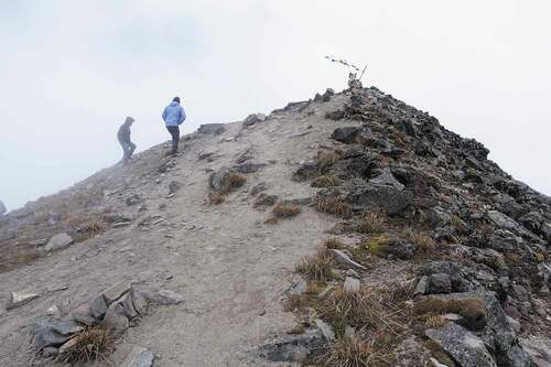
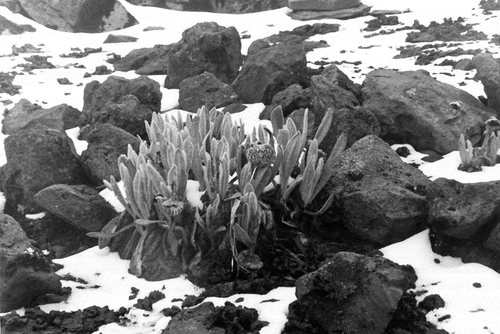
Figure 3. Clump of Senecio canescens near the summit of Mt. Corazón in January 1986. Photograph taken by P. Moret
Supplemental material