Figures & data
Figure 1. Map of study area (Source: (Quader et al., Citation2017), Note: Studied districts are marked with red colour.
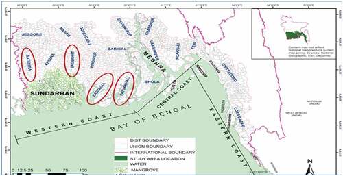
Table 1. Depicting the study area.
Figure 2. Data collection at different villages.
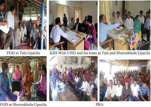
Table 2. Approaches of data collection and outcomes.
Table 3. Disaster experiences in southwestern coastal villages since 1980s to 2021.
Table 4. Problems faced in previous disasters and lesson learnt.
Figure 3. Practices and awareness after lessons learned from previous disasters.
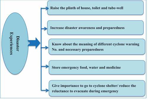
Figure 4. Problem tree of southwestern coastal villages.
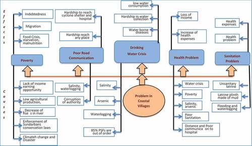
Table 5. Problems ranking in southwestern coastal area of Bangladesh.
Figure 5. Glimpses of coastal villages’ problems (poor road condition, unhealthy sanitation, and poor infrastructure facilities).
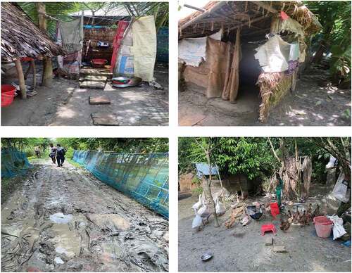
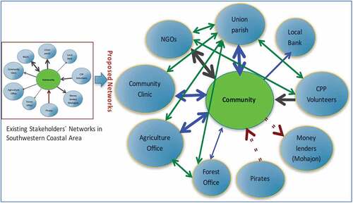
Figure 6. Stakeholders networking and infrastructures for disaster resilienct coastal community.