Figures & data
Figure 1. Population (%) in self-rated health (1 = very good, 5 = very poor) and perceived exposure to environmental hazard (1 = very low, 5 = very high) categories.
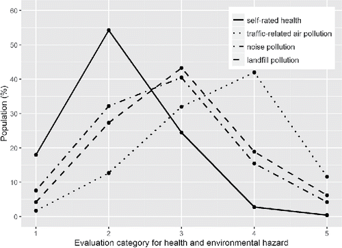
Figure 2. Population (%) reporting good or very good health by environmental hazard (1 = very low, 5 = very high) category with 95 percent confidence intervals.
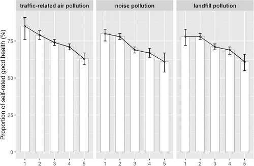
Figure 3. Spatial distribution of self-rated good health and perceived environmental hazard indexes at subdistrict level in urban Beijing.
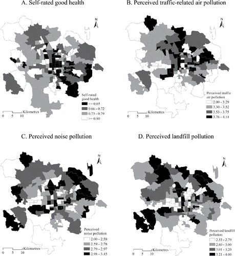
Table 1. Key sociodemographic attributes in the residential satisfaction and health survey
Table 2. Model fit comparisons
Table 3. Estimation results from the spatial LCAR multilevel logistic model
Figure 4. The impacts of significant covariates on self-rated health based on the results in (a value > 1 indicates positive effect and a value <1 indicates negative effect).
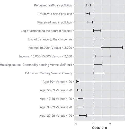
Table 4. Estimation results from the spatial LCAR multilevel logistic model with perceived environmental hazards as binary variables
Figure 5. District-level random effects on self-rated health. The breaking points correspond to the lower, median, and upper quartiles of the district effects.
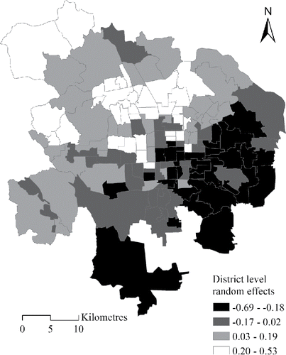
Figure 6. Population (%) in self-rated good health across income categories and age cohorts.
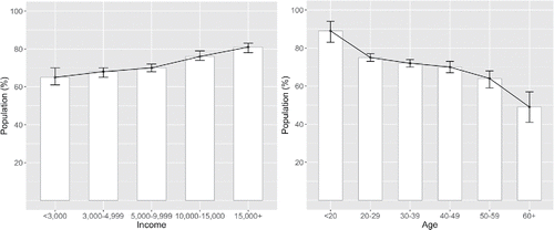
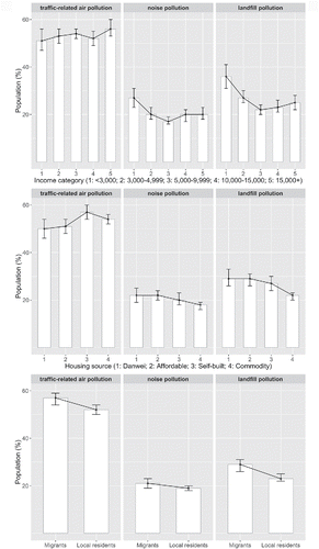
Figure 7. Population (%) in perceived high (and very high) exposure to environmental hazards across different sociodemographic strata.