Figures & data
Figure 1. Field photographs (A) destroyed house (B) flood lines inside a house.
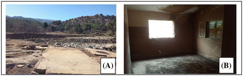
Figure 2. Study area location. Source: Author.
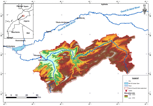
Table 1. Tillouguite station’ description.
Figure 3. Land use/cover annual evolution since October 1987 to 2017. Source: Geographic information system (QGIS) Open source.
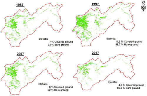
Figure 4. Land use /cover rate evolution according to instantaneous flow peak and maximum monthly rainfall per year since 1987.
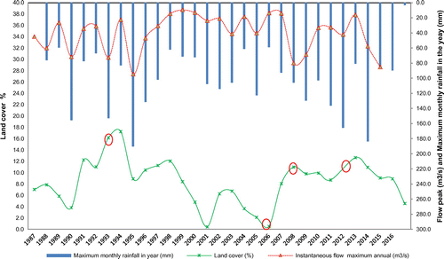
Table 2. Alfet watershed general characteristics.
Figure 5. Monthly rainfall graphic representation according to Normal low.
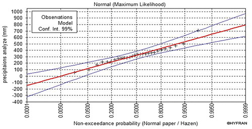
Table 3. Distributions low comparison criteria.
Table 4. Precipitation statistical adjustment results by normal low.
Table 5. Flow results according to different recurrences times.
Table 6. Extract from the simulation table results.
Figure 6. (A) Flooding zones in 3D schema (B) water level in a cross section.
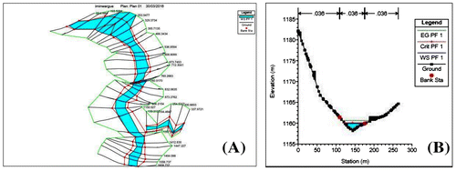
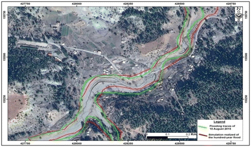
Figure 7. Inundation zones limits in a Google Earth background. Source: Author.