Figures & data
Figure 1. Study area. Source: Information Obtained from Survey of India Open Series Map.
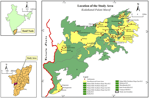
Figure 2. Administrative divisions. Source: Compiled information obtained from Survey of India Open Series Map and Taluk map published by Government of Tamil Nadu.
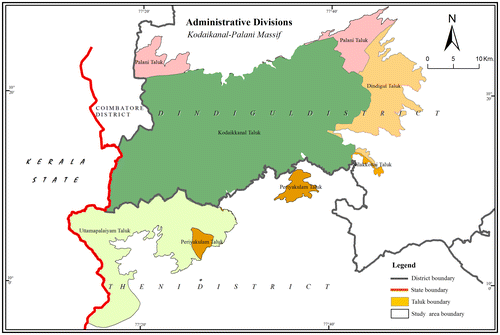
Figure 3. Rock types. Source: Information obtained from published geology map by Geological Survey of India.
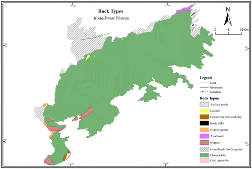
Table 1. Rock types of the study area and their areal extent.
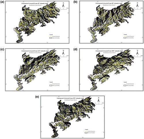
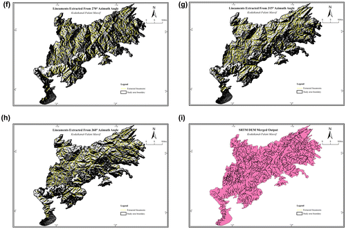
Figure 5. Lineaments extracted from Lansat OLI. Source: From Landsat 8 Satellite's OLI Sensor obtained from Online Resources.
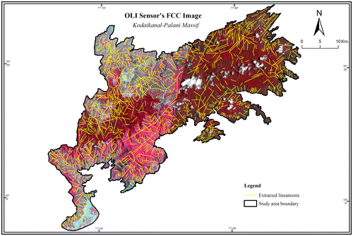
Figure 6. Final output. Source: Generated both from SRTM and Landsat 8 OLI satellite images.
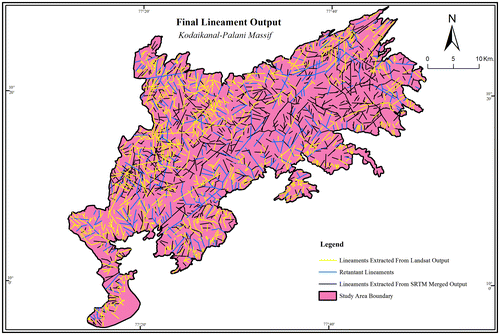
Table 2. Total number of lineaments in SRTM DEM image.
Table 3. Lineament density classes and their areal extent.
Figure 7. Lineament density. Source: Generated both from SRTM and Landsat 8 OLI satellite images.
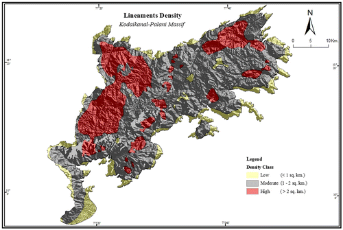
Figure 8. (a–h) Orientation of lineaments extracted from SRTM DEM. (i) Orientation of lineaments – from the merged output of SRTM DEM.
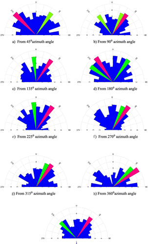
Figure 9. Orientation of lineaments extracted – from Landsat-8 Satellite’s OLI sensor’s FCC.
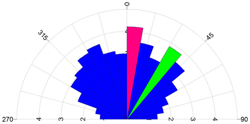
Figure 10. Orientation of lineaments (both from SRTM DEM and OLI sensor’s FCC).
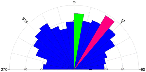
Figure 11. Orientation of lineaments of varied sizes extracted from SRTM DEM.
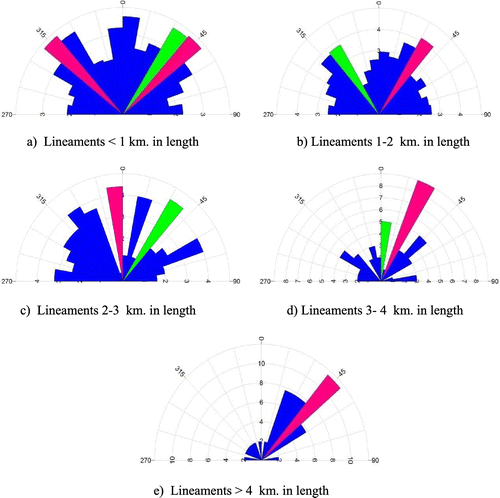
Figure 12. Orientation of lineaments of varied sizes extracted from Landsat-8 Satellite’s OLI sensor.
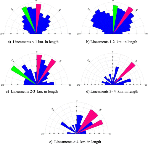
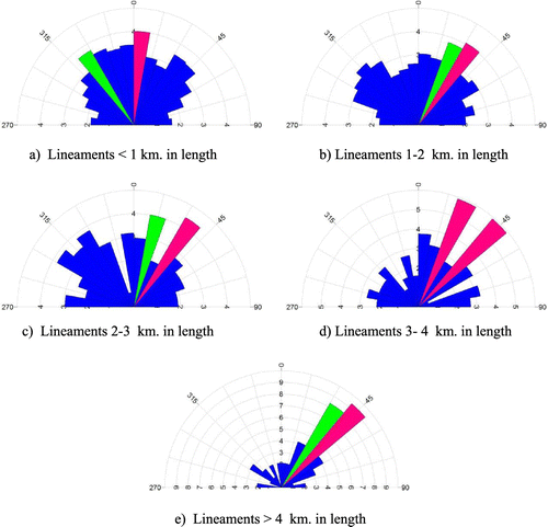
Figure 13. Orientation of lineaments of varied sizes: SRTM DEM + Landsat-8 Satellite’s OLI sensor.