Figures & data
Figure 1. The geographic location of Dhungeta-Ramis sub-basin
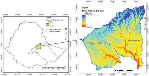
Figure 2. Conceptual framework adopted for the generation of groundwater potential map
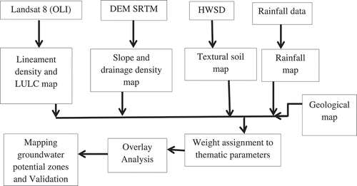
Figure 3. Lithology map of the study area
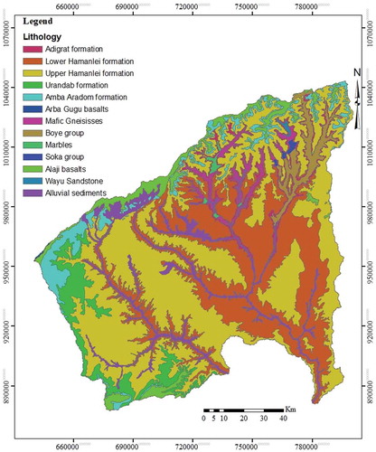
Table 1. Characteristic features of lithological groups in the Dhungeta-Ramis sub-basin (source: Alemu, Citation2010; Gebrekidan, Citation2005; Kebede, Citation2013; Teklay, Kroner, Mezger, & Oberhonsl, Citation1998)
Figure 4. Land use land cover map of the study area
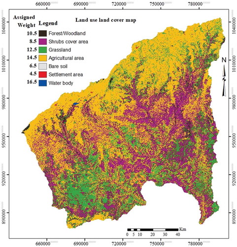
Figure 5. Lineament density map of the study area
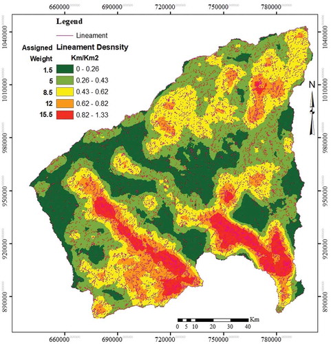
Table 2. Categorization of factors influencing groundwater movement and occurrence and their associated aerial extent within the study area
Figure 6. Slope class map of the study area
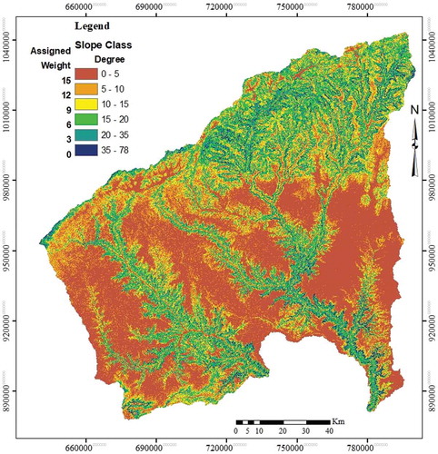
Figure 7. Drainage density map of the study area
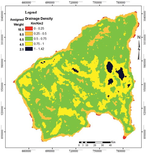
Figure 8. Rainfall map of the study area
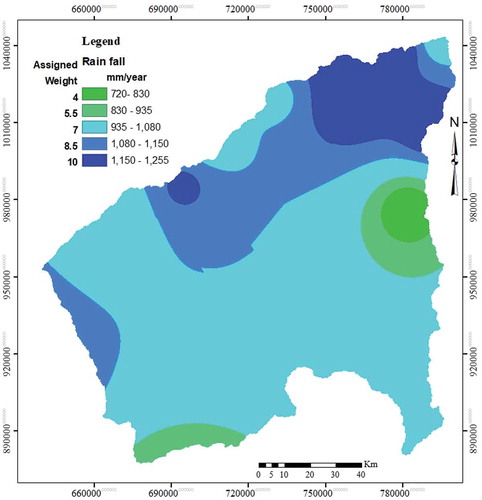
Figure 9. Soil map of the study area
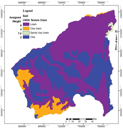
Figure 10. Groundwater potential zone map of the study area
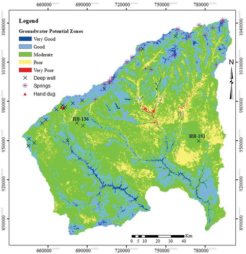
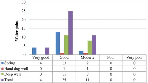
Figure 11. Comparison of groundwater prospective area map generated using weighted overlay analysis of multi-criteria techniques and water point (springs, hand-dug, and deep well)