Figures & data
Figure 1. The location map of the study area.
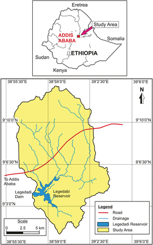
Figure 2. Flow chart of the methodology.
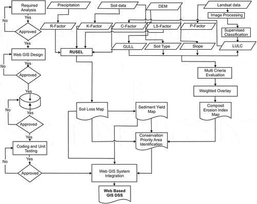
Table 1. Soil erodibility values for soil types (Helden, Citation1987).
Figure 3. Overall layout of the Web-GIS monitoring platform.
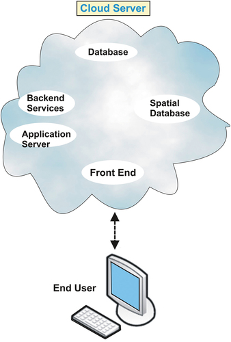
Figure 4. Iterative model development and its life cycle.
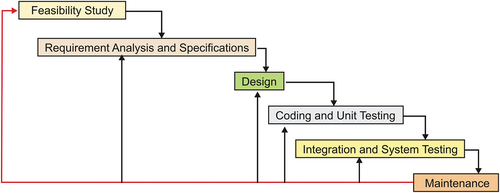
Figure 5. General system architecture-Client computer and Server computer.
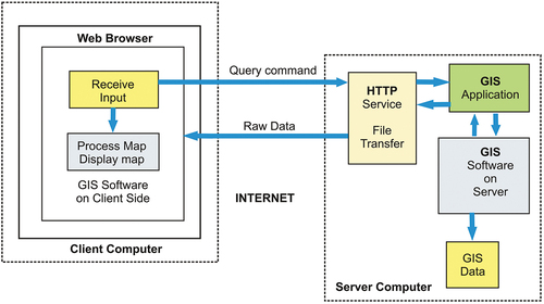
Figure 6. Web-GIS Architecture and process line diagram.
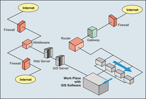
Table 2. Details of rainfall station in the Legedadi watershed.
Figure 7. (a) Mean annual rainfall, (b) Distribution of Rainfall erosivity factor (R).
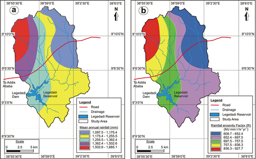
Table 3. Soil classes and respective Soil erodibility (K) factor value.
Figure 8. (a) Distribution of soil types, (b) Distribution of soil erodibility factor (K).
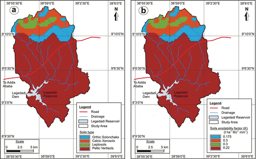
Figure 9. (a) Slope length (X), (b) slope gradient (S), and (c) slope length and steepness (LS) factors.
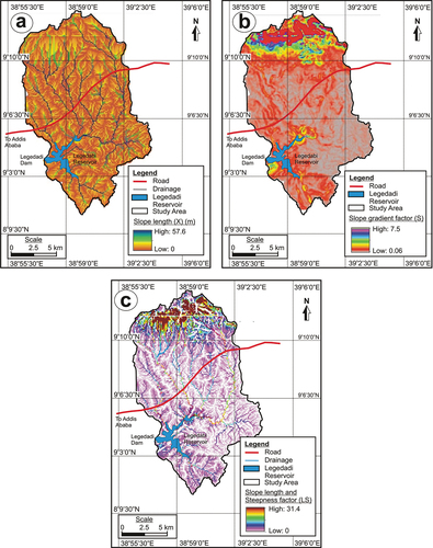
Table 4. Land-use/land-cover classes with respective Cover−management practice factor (C).
Figure 10. (a) Land-use/land-cover map, (b) Cover−management practice factor (C), and (c) Support practice factor (P).
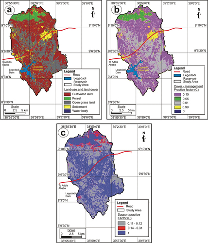
Table 5. P factor value for land-use and land-cover classes with respect to slope (Wischmeier & Smith, Citation1978).
Table 6. Soil erosion estimation in the study area.
Table 7. Soil erosion estimation at micro-watershed level in the study area.
Figure 11. Soil erosion estimation (a) overall study area, and (b) micro-watershed level.
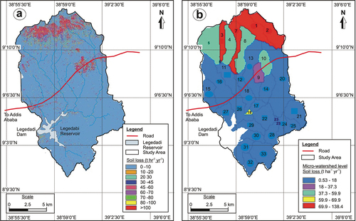
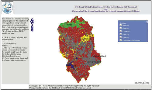
Figure 12. Developed WebGIS-based soil loss information dissemination user interface.