Figures & data
Figure 1. Location map of the study area.
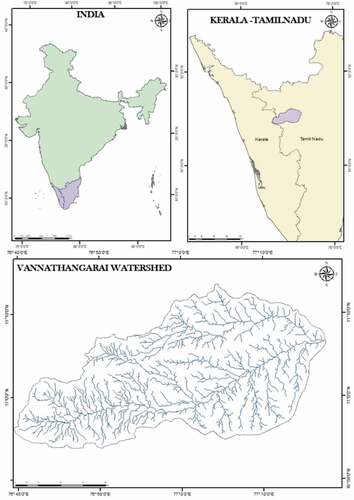
Table 1. Morphometric characteristics of Vannathangarai watershed.
Table 2. Basin geometry parameters.
Figure 2. Drainage map.
(Source: SRTM-DEM)
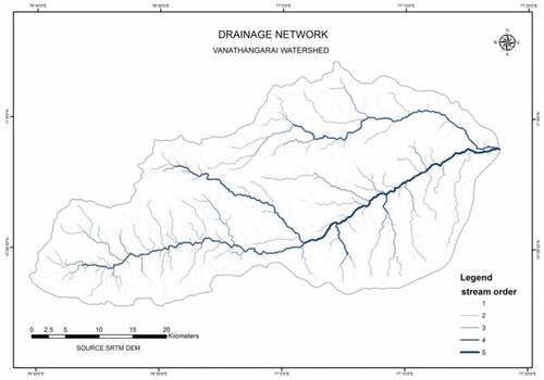
Figure 3. Interrelation of stream order with the number of streams.
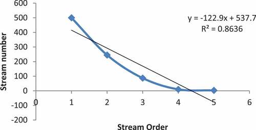
Figure 4. Interrelationship between stream order and stream length.
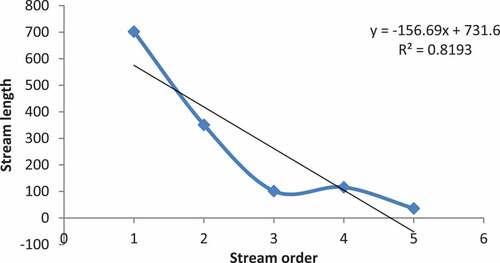
Figure 5. Interrelationship between stream order and Lsm.
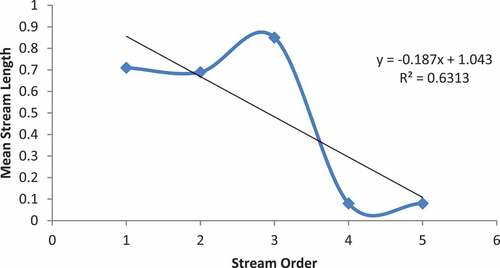
Table 3. Linear parameters of the Vannathangarai watershed.
Table 4. Aerial parameters.
Figure 6. Drainage density map.
(Source: SRTM-DEM)
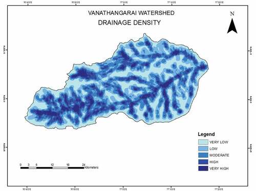
Table 5. Relief parameters.
Figure7. Slope map.
(Source: SRTM-DEM)
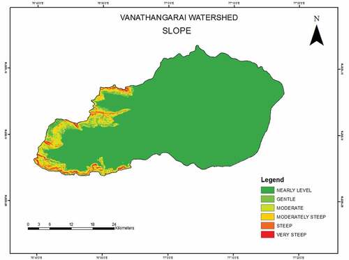
Figure 8. Aspect map.
(Source: SRTM-DEM)
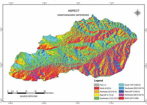
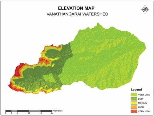
Figure 9. Elevation map.
(Source: SRTM-DEM)